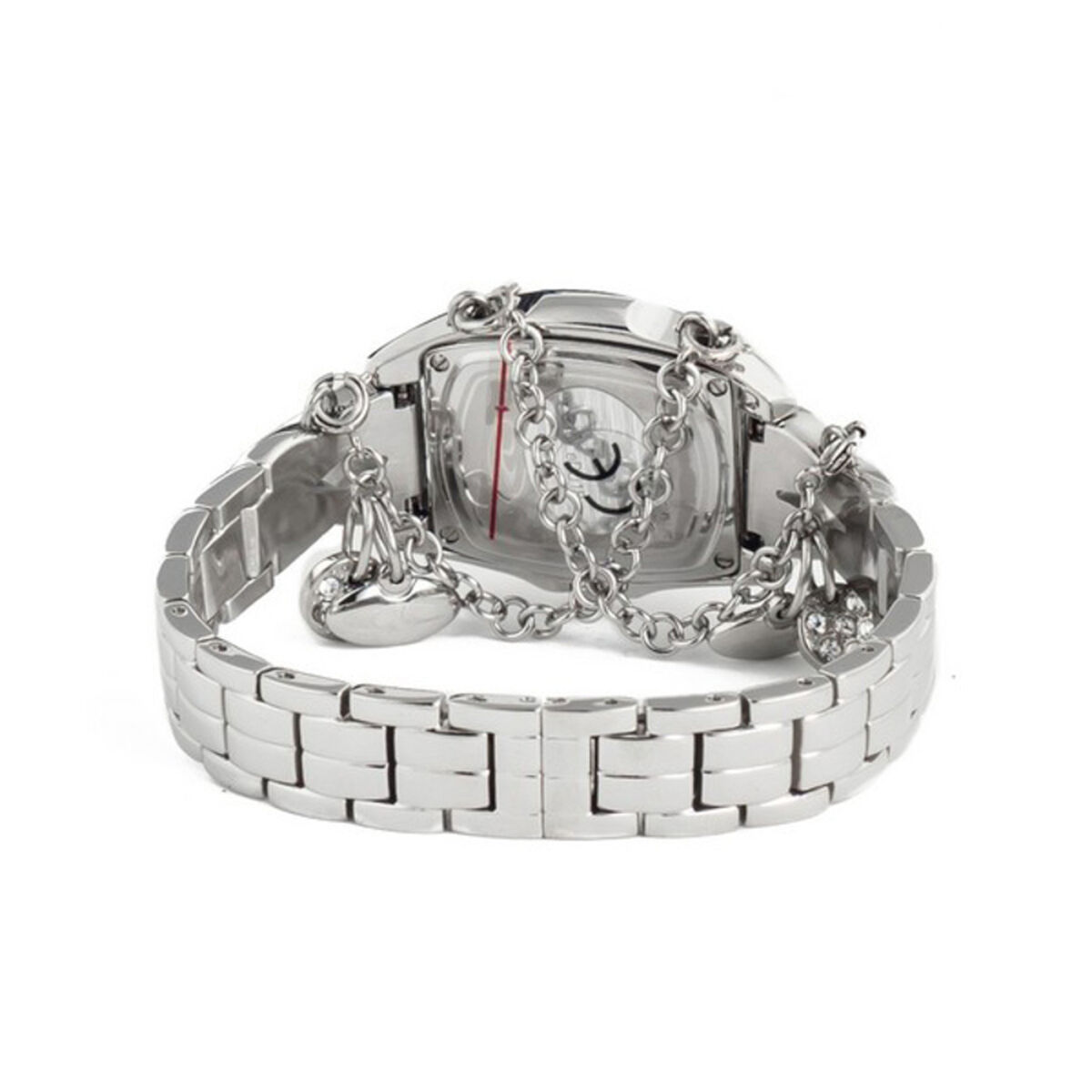
Montre Femme Guess Y18001L1 (Ø 32 mm)
Privilege Price 153.80 €Si vous aimez suivre les dernières tendances en matière de mode et accessoires, achetez Montre Femme Guess Y18001L1 (Ø 32 mm) au meilleur prix.Couleur: ArgentéGenre: FemmeLiens supplémentaires: NonType de montre: Montre-braceletMatériau du bracelet: AcierMatériau du boîtier de la montre: Acier inoxydableType de mouvement: QuartzVerre: MinéralImperméabilité: 10 atmInclut: Le coffret de la marque est inclusType de...


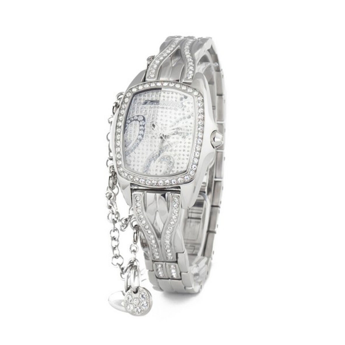
Montre Femme Guess W0844L1 (Ø 40 mm)
Privilege Price 97.10 €Si vous aimez suivre les dernières tendances en matière de mode et accessoires, achetez Montre Femme Guess W0844L1 (Ø 40 mm) au meilleur prix.Genre: FemmeLiens supplémentaires: NonType de montre: Montre-braceletdiamètre approx.: 35 mmMatériau du bracelet: TextileMatériau du boîtier de la montre: Acier inoxydableType de mouvement: QuartzVerre: MinéralImperméabilité: 5 atmInclut: Le coffret de la marque est...
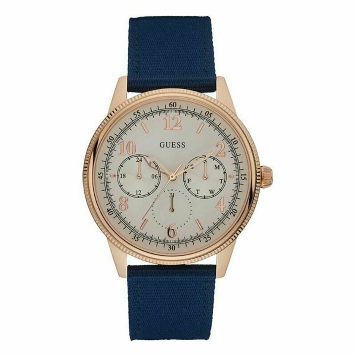

Montre Homme Guess W0863G4 (Ø 44 mm)
Privilege Price 83.10 €Si vous aimez suivre les dernières tendances en matière de mode et accessoires, achetez Montre Homme Guess W0863G4 (Ø 44 mm) au meilleur prix.Couleur du bracelet: BleuCouleur du cadran: BeigeType de fermeture: BoucleImperméabilité: 5 atmInclut: Le coffret de la marque est inclusType de mouvement: QuartzMatériau du boîtier de la montre: Acier inoxydableDiamètre du boîtier de...
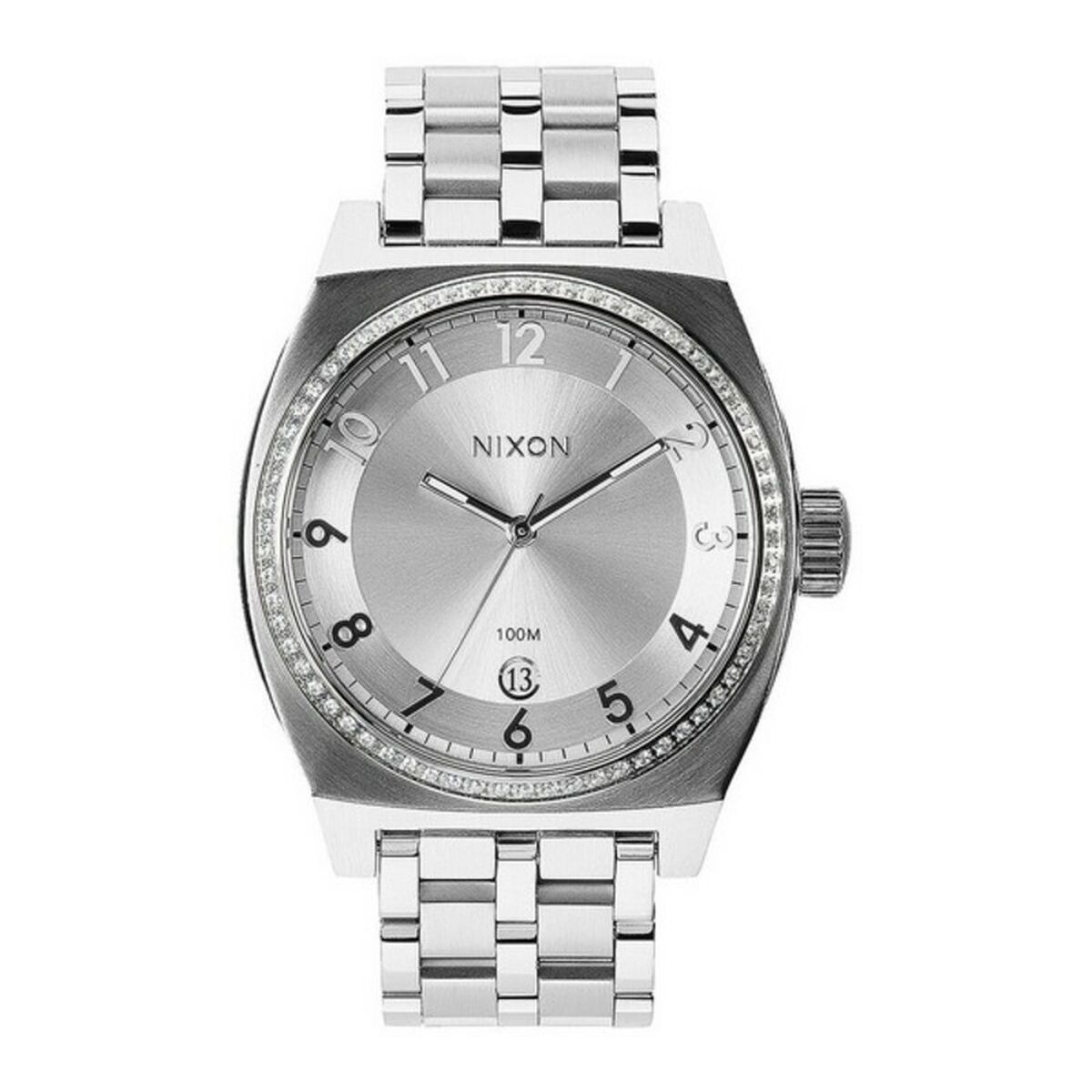

Montre Femme Nixon A325-1874-00 (Ø 40 mm)
Privilege Price 76.40 €Si vous aimez suivre les dernières tendances en matière de mode et accessoires, achetez Montre Femme Nixon A325-1874-00 (Ø 40 mm) au meilleur prix.Genre: FemmeLiens supplémentaires: NonType de montre: Montre-braceletMatériau du bracelet: AcierMatériau du boîtier de la montre: Acier inoxydableType de mouvement: QuartzVerre: MinéralImperméabilité: 10 atmInclut: Le coffret de la marque est inclusType de fermeture:...
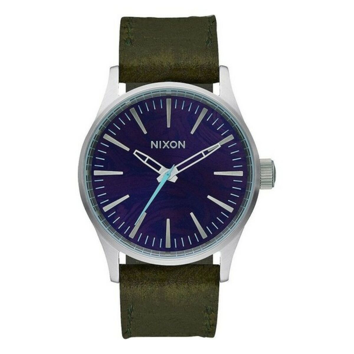
Montre Femme Nixon A377-2302-00 (Ø 38 mm)
Privilege Price 76.40 €Si vous aimez suivre les dernières tendances en matière de mode et accessoires, achetez Montre Femme Nixon A377-2302-00 (Ø 38 mm) au meilleur prix.Matériau du bracelet: CuirCouleur du bracelet: VertCouleur du boîtier de l'horloge: GrisType de fermeture: BoucleImperméabilité: 10 atmVerre: MinéralCouleur du cadran: BleuInclut: Le coffret de la marque est inclusType de mouvement: QuartzMatériau du...
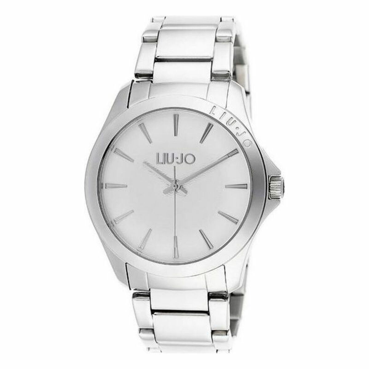

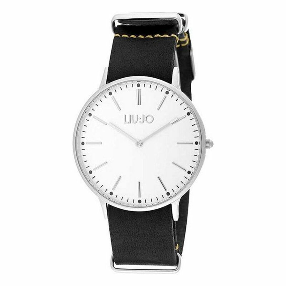
Montre Homme LIU JO TLJ811 (Ø 40 mm)
Privilege Price 59.30 €Si vous aimez suivre les dernières tendances en matière de mode et accessoires, achetez Montre Homme LIU JO TLJ811 (Ø 40 mm) au meilleur prix.Couleur: ArgentéGenre: HommeType de montre: Montre-braceletLiens supplémentaires: NonMatériau du bracelet: AcierMatériau du boîtier de la montre: Acier inoxydableType de mouvement: QuartzVerre: MinéralImperméabilité: 5 atmInclut: Le coffret de la marque est inclusType...


Montre Femme Nixon A403-1749-00 (Ø 26 mm)
Privilege Price 57.90 €Si vous aimez suivre les dernières tendances en matière de mode et accessoires, achetez Montre Femme Nixon A403-1749-00 (Ø 26 mm) au meilleur prix.Genre: FemmeLiens supplémentaires: NonType de montre: Montre-braceletMatériau du bracelet: CuirMatériau du boîtier de la montre: Acier inoxydableType de mouvement: QuartzVerre: MinéralImperméabilité: 5 atmInclut: Le coffret de la marque est inclusType de fermeture:...
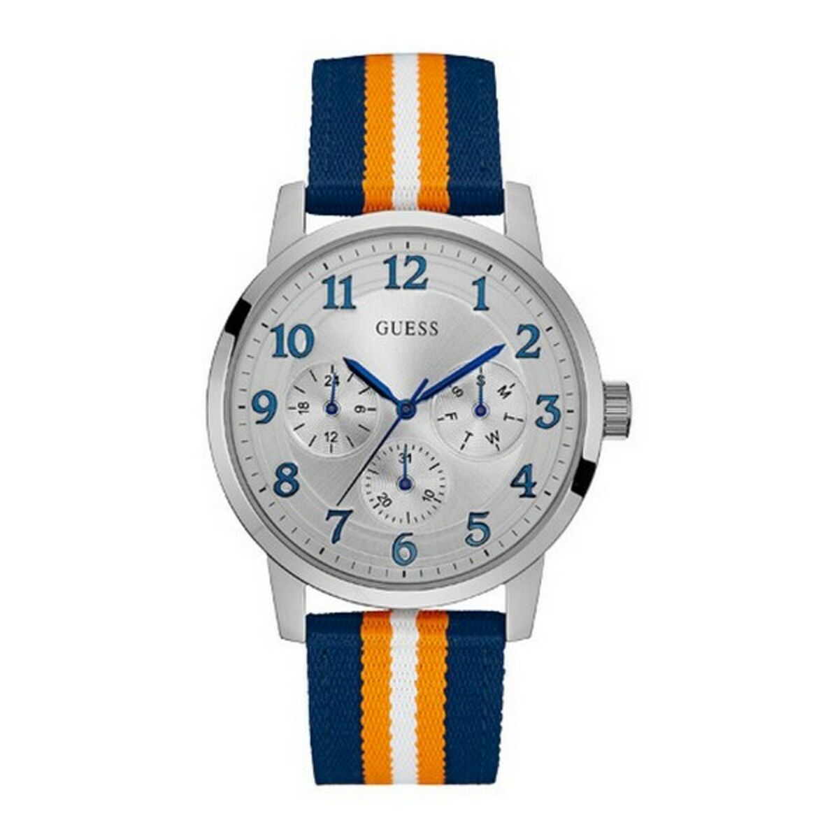

Montre Homme Guess W0975G2 (Ø 44 mm)
Privilege Price 56.40 €Si vous aimez suivre les dernières tendances en matière de mode et accessoires, achetez Montre Homme Guess W0975G2 (Ø 44 mm) au meilleur prix.Couleur: ArgentéGenre: HommeType de montre: Montre-braceletLiens supplémentaires: NonMatériau du bracelet: NylonMatériau du boîtier de la montre: Acier inoxydableType de mouvement: QuartzVerre: MinéralInclut: Le coffret de la marque est inclusType de fermeture: BoucleCouleur...
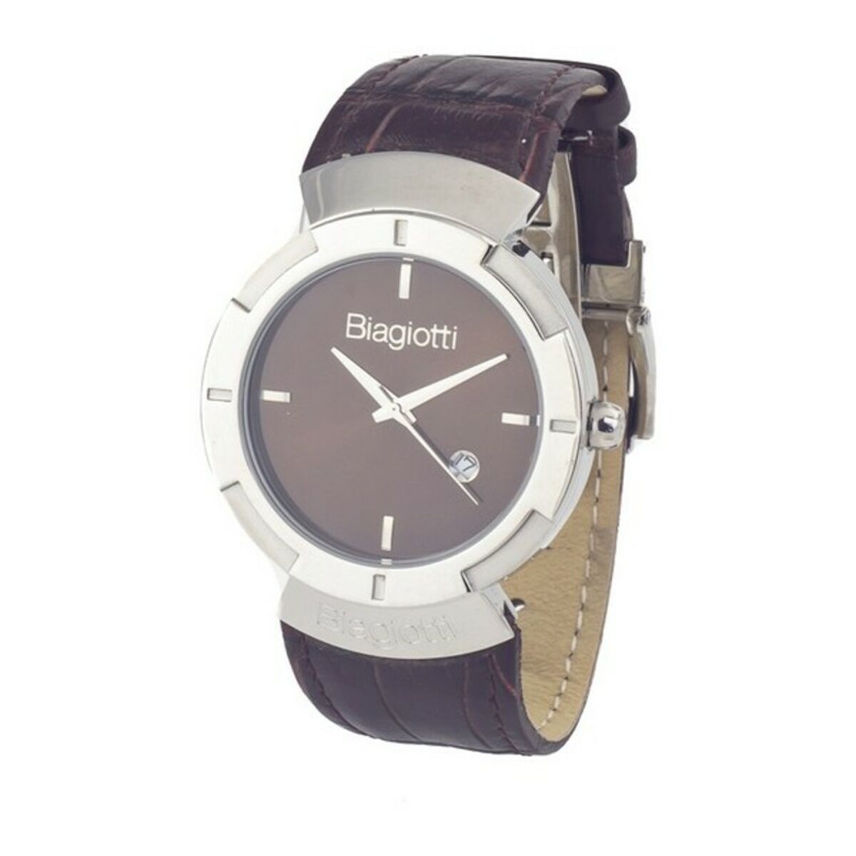
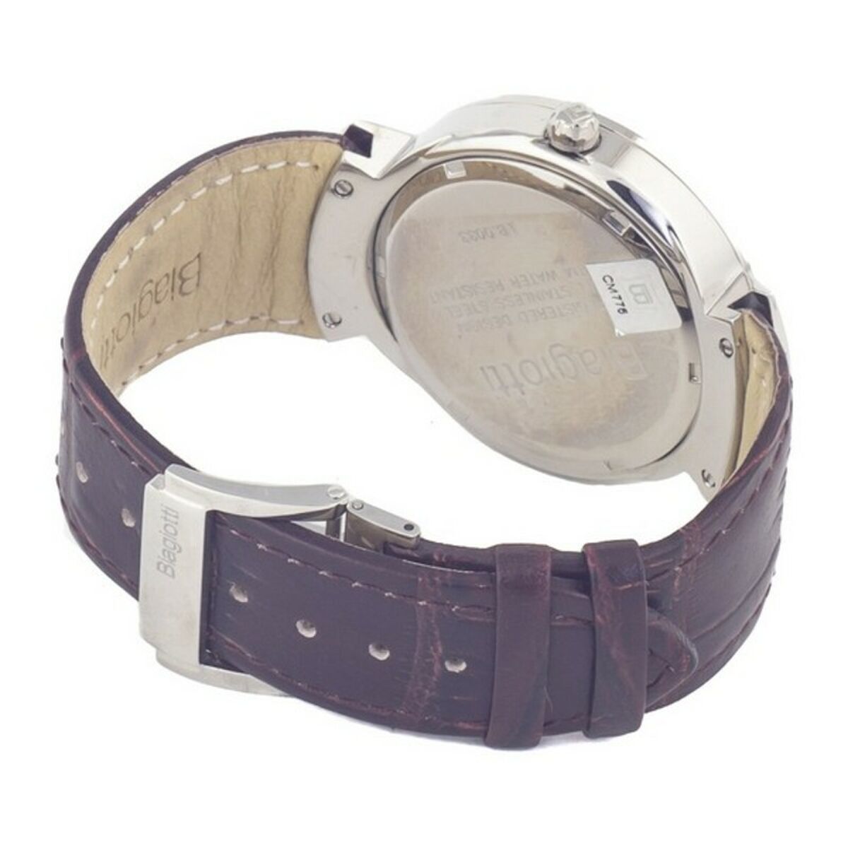
Montre Homme Laura Biagiotti LB0033M-04 (Ø 40 mm)
Privilege Price 55.70 €Si vous aimez suivre les dernières tendances en matière de mode et accessoires, achetez Montre Homme Laura Biagiotti LB0033M-04 (Ø 40 mm) au meilleur prix.Matériau du bracelet: CuirCouleur du bracelet: MarronType de fermeture: BoucleVerre: MinéralDiamètre du boîtier: Ø 40 mmCouleur du cadran: MarronImperméabilité: NonInclut: Le coffret de la marque est inclusType de mouvement: QuartzCouleur du...

Montre Femme Nixon A403-1675-00 (Ø 26 mm)
Privilege Price 52.90 €Si vous aimez suivre les dernières tendances en matière de mode et accessoires, achetez Montre Femme Nixon A403-1675-00 (Ø 26 mm) au meilleur prix.Genre: FemmeLiens supplémentaires: NonType de montre: Montre-braceletMatériau du bracelet: CuirMatériau du boîtier de la montre: Acier inoxydableType de mouvement: QuartzVerre: MinéralImperméabilité: 5 atmInclut: Le coffret de la marque est inclusType de fermeture:...


Montre Femme Nixon A399-1898-00 (Ø 27 mm)
Privilege Price 49.90 €Si vous aimez suivre les dernières tendances en matière de mode et accessoires, achetez Montre Femme Nixon A399-1898-00 (Ø 27 mm) au meilleur prix.Matériau du bracelet: AcierType de fermeture: A pressionImperméabilité: 10 atmVerre: MinéralCouleur du cadran: VertInclut: Le coffret de la marque est inclusType de mouvement: QuartzCouleur du boîtier de l'horloge: ArgentéCouleur du bracelet: ArgentéMatériau...

Parfum Femme Floral Blush Coach COACH FLORAL EDP (90 ml) EDP 90 ml
Privilege Price 46.60 €Laissez-vous surprendre par le parfum de marque Parfum Femme Floral Blush Coach COACH FLORAL EDP (90 ml) EDP 90 ml et faites ressortir votre féminité en portant ce parfum femme 100 % authentique. Sa composition unique exalte un parfum à votre image. Découvrez sans plus tarder nos produits Coach 100 % authentiques !Genre: FemmeCapacité: 90 mlType:...

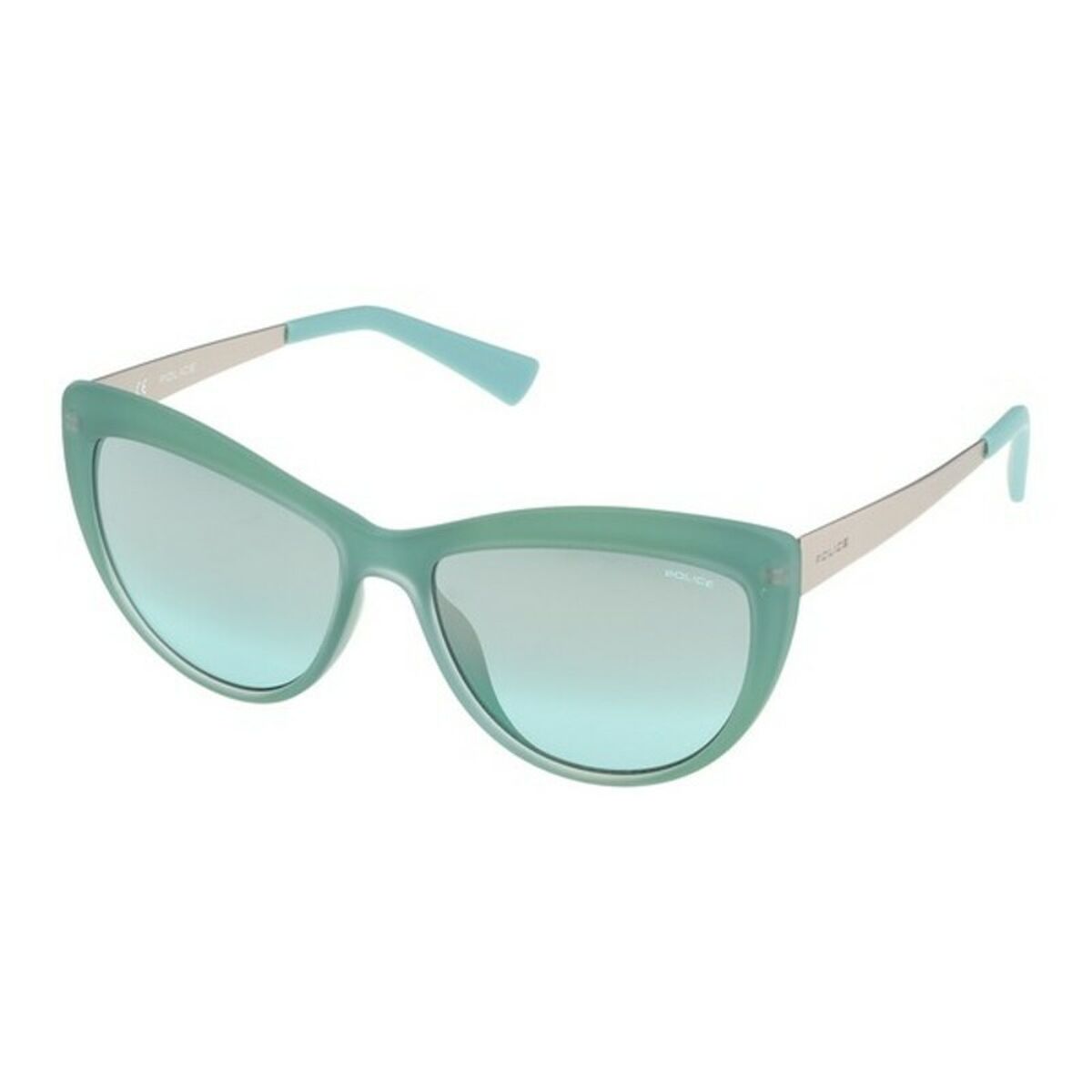
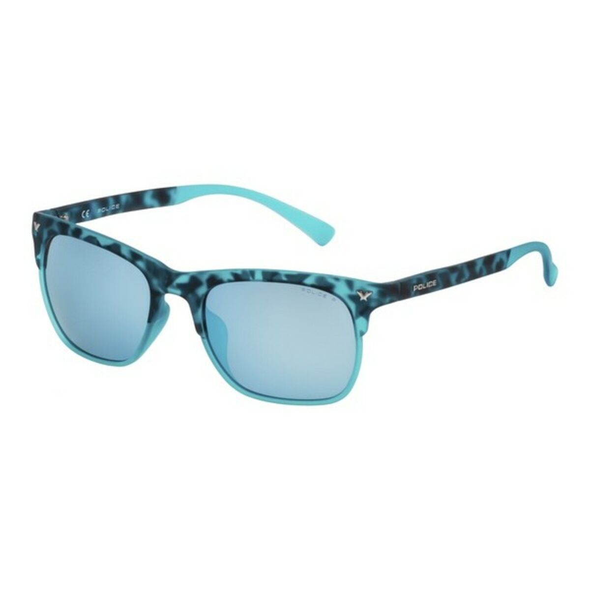
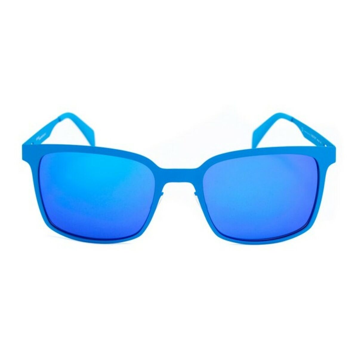
Lunettes de soleil Homme Police S194450715B Ø 50 mm
Privilege Price 45.20 €Si vous aimez avoir les dernières nouveautés enmode et accessoires et si les accessoires sont indispensables pour l'ensemble de votre image, ne passez pas à côté de Lunettes de soleil Homme Police S194450715B Ø 50 mm ! Bénéficiez des meilleures marques de lunettes de soleil.Genre: HommeMatériel: InjectéPolycarbonateProtection solaire: catégorie 2Branches: 140 mmPont: 22 mmType: Lunettes...
Lunettes de soleil Homme Police S194450878R Ø 50 mm
Privilege Price 45.20 €Si vous aimez avoir les dernières nouveautés enmode et accessoires et si les accessoires sont indispensables pour l'ensemble de votre image, ne passez pas à côté de Lunettes de soleil Homme Police S194450878R Ø 50 mm ! Bénéficiez des meilleures marques de lunettes de soleil.Genre: HommeMatériel: InjectéPolycarbonateProtection solaire: catégorie 2Branches: 140 mmPont: 22 mmType: Lunettes...
Lunettes de soleil Homme Police S194450NVNG Ø 50 mm
Privilege Price 45.20 €Si vous aimez avoir les dernières nouveautés enmode et accessoires et si les accessoires sont indispensables pour l'ensemble de votre image, ne passez pas à côté de Lunettes de soleil Homme Police S194450NVNG Ø 50 mm ! Bénéficiez des meilleures marques de lunettes de soleil.Genre: HommeMatériel: InjectéPolycarbonateProtection solaire: catégorie 2Branches: 140 mmPont: 22 mmType: Lunettes...
Lunettes de soleil Homme Police S194450U11B Ø 50 mm
Privilege Price 45.20 €Si vous aimez avoir les dernières nouveautés enmode et accessoires et si les accessoires sont indispensables pour l'ensemble de votre image, ne passez pas à côté de Lunettes de soleil Homme Police S194450U11B Ø 50 mm ! Bénéficiez des meilleures marques de lunettes de soleil.Genre: HommeMatériel: InjectéPolycarbonateProtection solaire: catégorie 2Branches: 140 mmPont: 22 mmType: Lunettes...
Lunettes de soleil Homme Police S194450U43B Ø 50 mm
Privilege Price 45.20 €Si vous aimez avoir les dernières nouveautés enmode et accessoires et si les accessoires sont indispensables pour l'ensemble de votre image, ne passez pas à côté de Lunettes de soleil Homme Police S194450U43B Ø 50 mm ! Bénéficiez des meilleures marques de lunettes de soleil.Genre: HommeMatériel: InjectéPolycarbonateProtection solaire: catégorie 2Branches: 140 mmPont: 22 mmType: Lunettes...
Lunettes de soleil Homme Police S1945 Ø 49 mm
Privilege Price 45.20 €Si vous aimez avoir les dernières nouveautés enmode et accessoires et si les accessoires sont indispensables pour l'ensemble de votre image, ne passez pas à côté de Lunettes de soleil Homme Police S1945 Ø 49 mm ! Bénéficiez des meilleures marques de lunettes de soleil.Genre: HommeMatériel: InjectéPolycarbonateProtection solaire: catégorie 2Branches: 140 mmPont: 21 mmType: Lunettes...
Lunettes de soleil Homme Police SPL086 Ø 65 mm
Privilege Price 45.20 €Si vous aimez avoir les dernières nouveautés enmode et accessoires et si les accessoires sont indispensables pour l'ensemble de votre image, ne passez pas à côté de Lunettes de soleil Homme Police SPL086 Ø 65 mm ! Bénéficiez des meilleures marques de lunettes de soleil.Genre: HommeMatériel: InjectéPolycarbonateProtection solaire: catégorie 2Branches: 140 mmPont: 17 mmType: Lunettes...
Lunettes de soleil Homme Police SPL151 Ø 15 mm
Privilege Price 45.20 €Si vous aimez avoir les dernières nouveautés enmode et accessoires et si les accessoires sont indispensables pour l'ensemble de votre image, ne passez pas à côté de Lunettes de soleil Homme Police SPL151 Ø 15 mm ! Bénéficiez des meilleures marques de lunettes de soleil.Genre: HommeMatériel: InjectéPolycarbonateProtection solaire: catégorie 2Branches: 145 mmPont: 18 mmType: Lunettes...
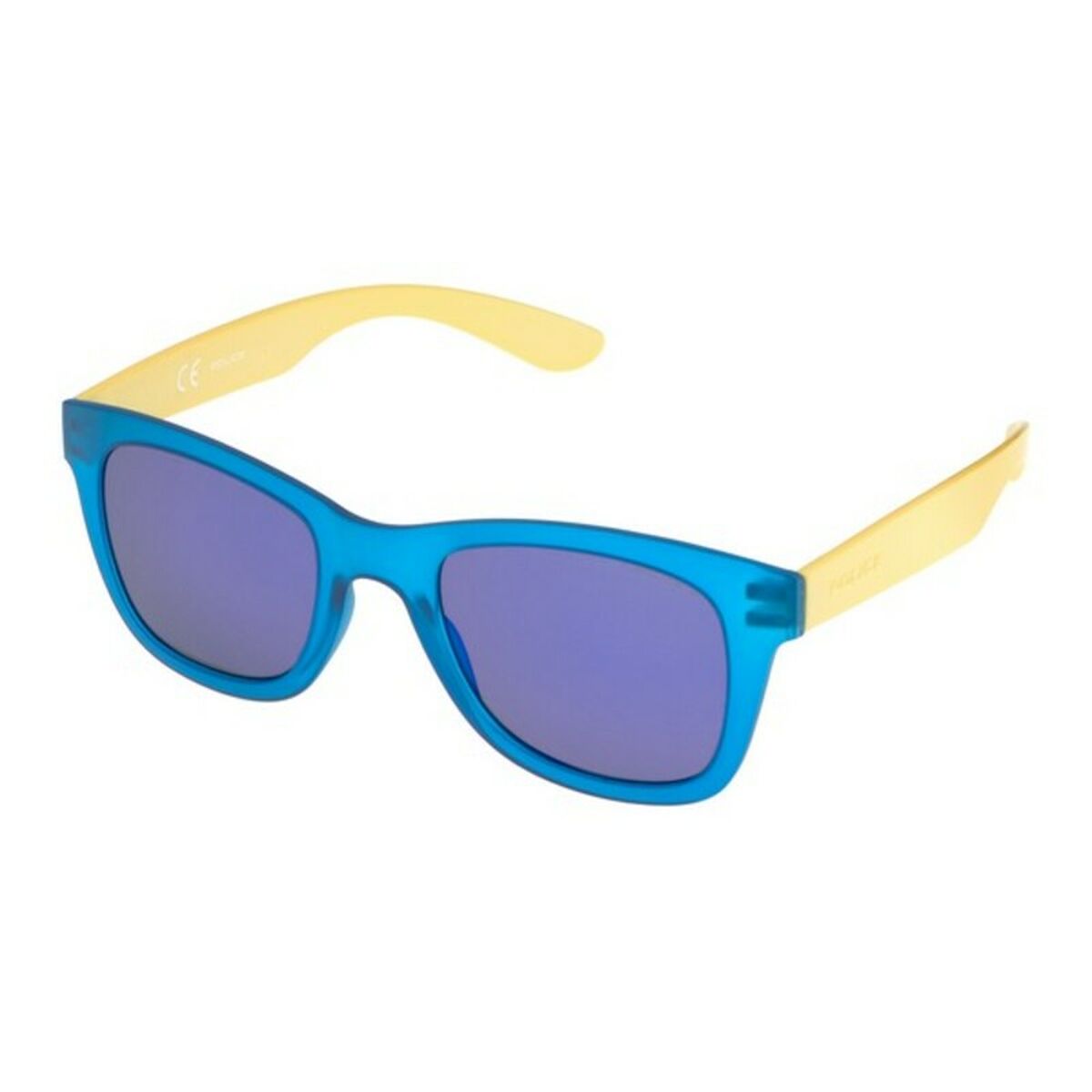
Lunettes de soleil Homme Police SPL190 ø 54 mm
Privilege Price 45.20 €Si vous aimez avoir les dernières nouveautés enmode et accessoires et si les accessoires sont indispensables pour l'ensemble de votre image, ne passez pas à côté de Lunettes de soleil Homme Police SPL190 ø 54 mm ! Bénéficiez des meilleures marques de lunettes de soleil.Genre: HommeMatériel: MétalPolycarbonateProtection solaire: catégorie 2Branches: 135 mmPont: 15 mmType: Lunettes...
Lunettes de soleil Homme Police SPL231 Ø 15 mm
Privilege Price 45.20 €Si vous aimez avoir les dernières nouveautés enmode et accessoires et si les accessoires sont indispensables pour l'ensemble de votre image, ne passez pas à côté de Lunettes de soleil Homme Police SPL231 Ø 15 mm ! Bénéficiez des meilleures marques de lunettes de soleil.Genre: HommeMatériel: InjectéMétalPolycarbonateProtection solaire: catégorie 2Branches: 145 mmPont: 17 mmType: Lunettes...

Montre Homme LIU JO LJW-TLJ965 (Ø 41 mm)
Privilege Price 45.10 €Si vous aimez suivre les dernières tendances en matière de mode et accessoires, achetez Montre Homme LIU JO LJW-TLJ965 (Ø 41 mm) au meilleur prix.Genre: HommeType de montre: Montre-braceletLiens supplémentaires: NonMatériau du bracelet: CuirMatériau du boîtier de la montre: Acier inoxydableType de mouvement: QuartzVerre: MinéralInclut: Le coffret de la marque est inclusType de fermeture: BoucleCouleur...
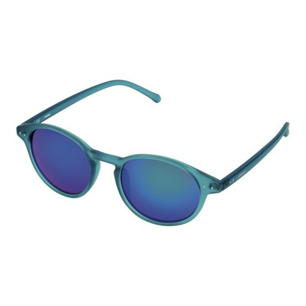
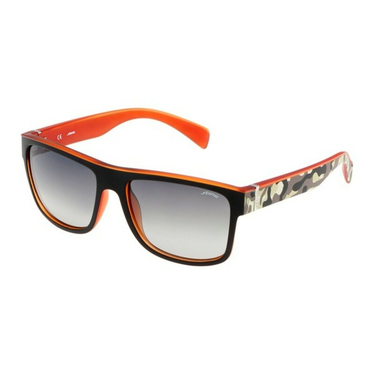
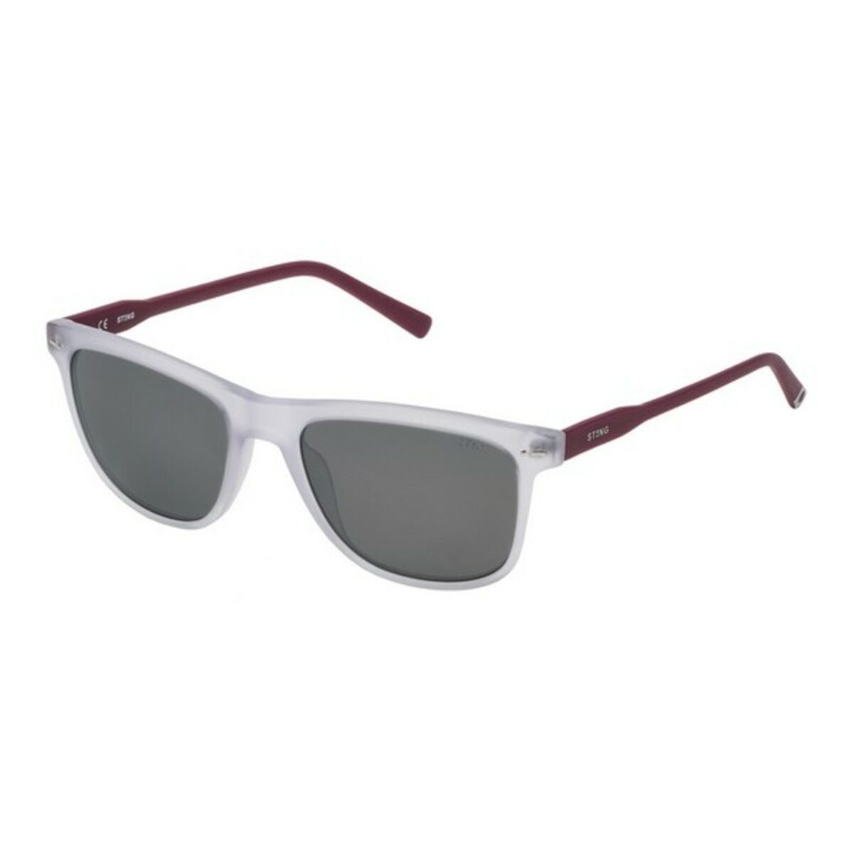
Lunettes de soleil Homme Sting SS6583 Ø 55 mm
Privilege Price 44.20 €Si vous aimez avoir les dernières nouveautés enmode et accessoires et si les accessoires sont indispensables pour l'ensemble de votre image, ne passez pas à côté de Lunettes de soleil Homme Sting SS6583 Ø 55 mm ! Bénéficiez des meilleures marques de lunettes de soleil.Genre: HommeMatériel: AcétatePolycarbonateProtection solaire: catégorie 2Branches: 140 mmPont: 15 mmType: Lunettes...
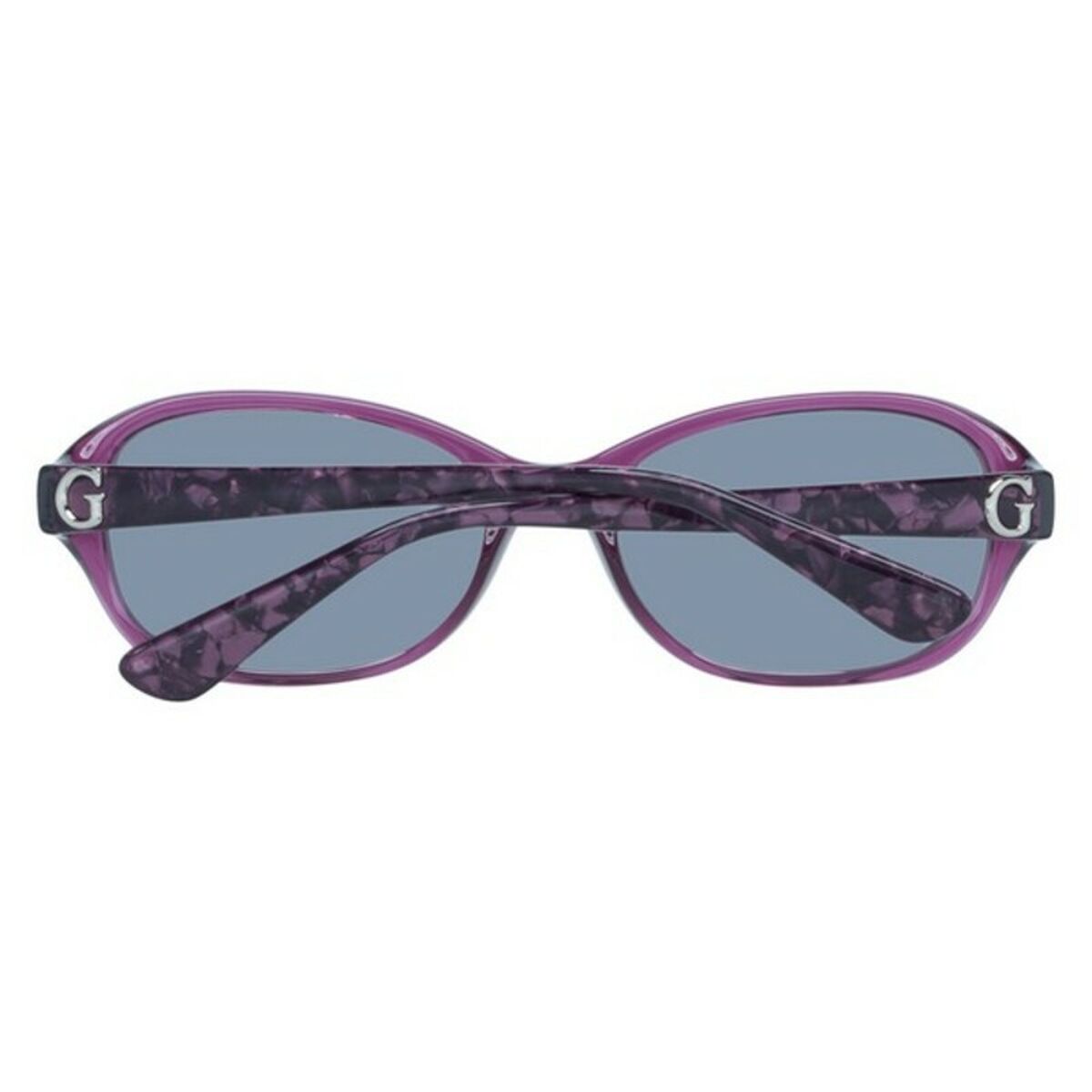
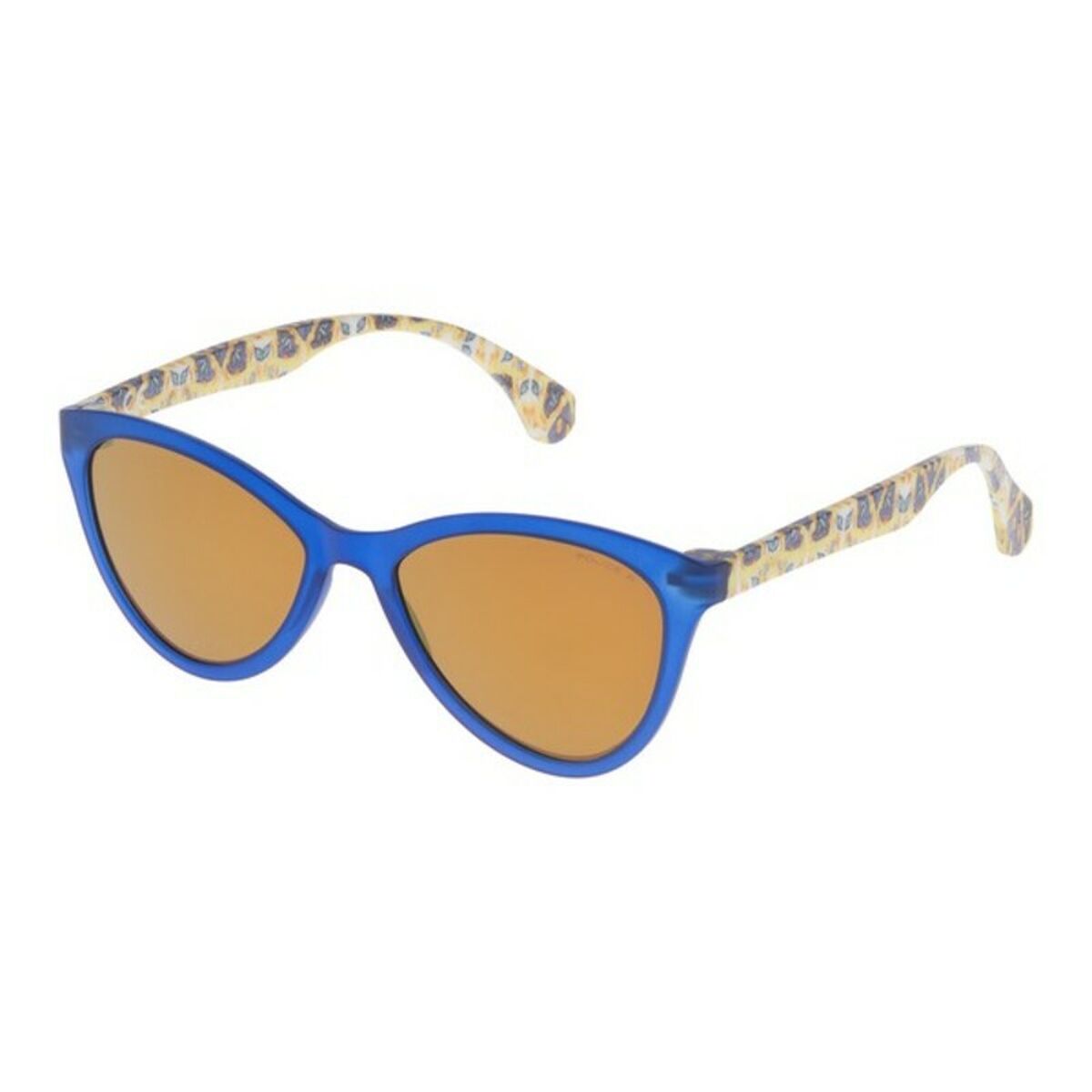
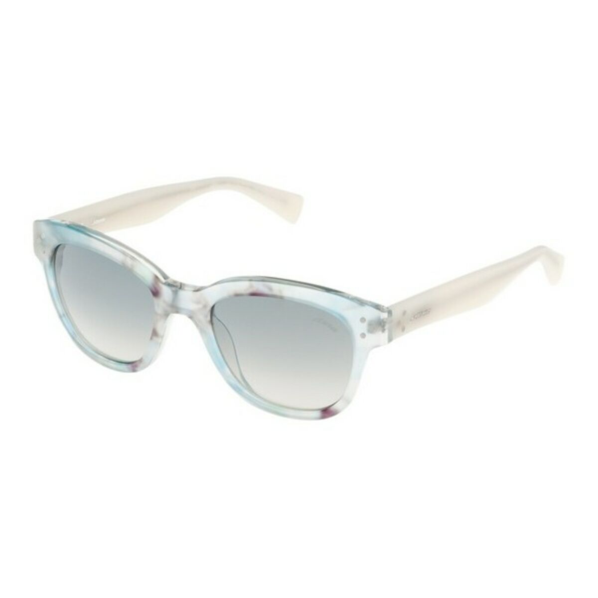
Lunettes de soleil Femme Guess GU 7356 O43 -57 -18 -0
Privilege Price 39.80 €Si vous aimez avoir les dernières nouveautés enmode et accessoires et si les accessoires sont indispensables pour l'ensemble de votre image, ne passez pas à côté de Lunettes de soleil Femme Guess GU 7356 O43 -57 -18 -0 ! Bénéficiez des meilleures marques de lunettes de soleil.Genre: FemmeMatériel: AcétateFiltre solaire: catégorie 3Branches: 143 mmPont: 18...
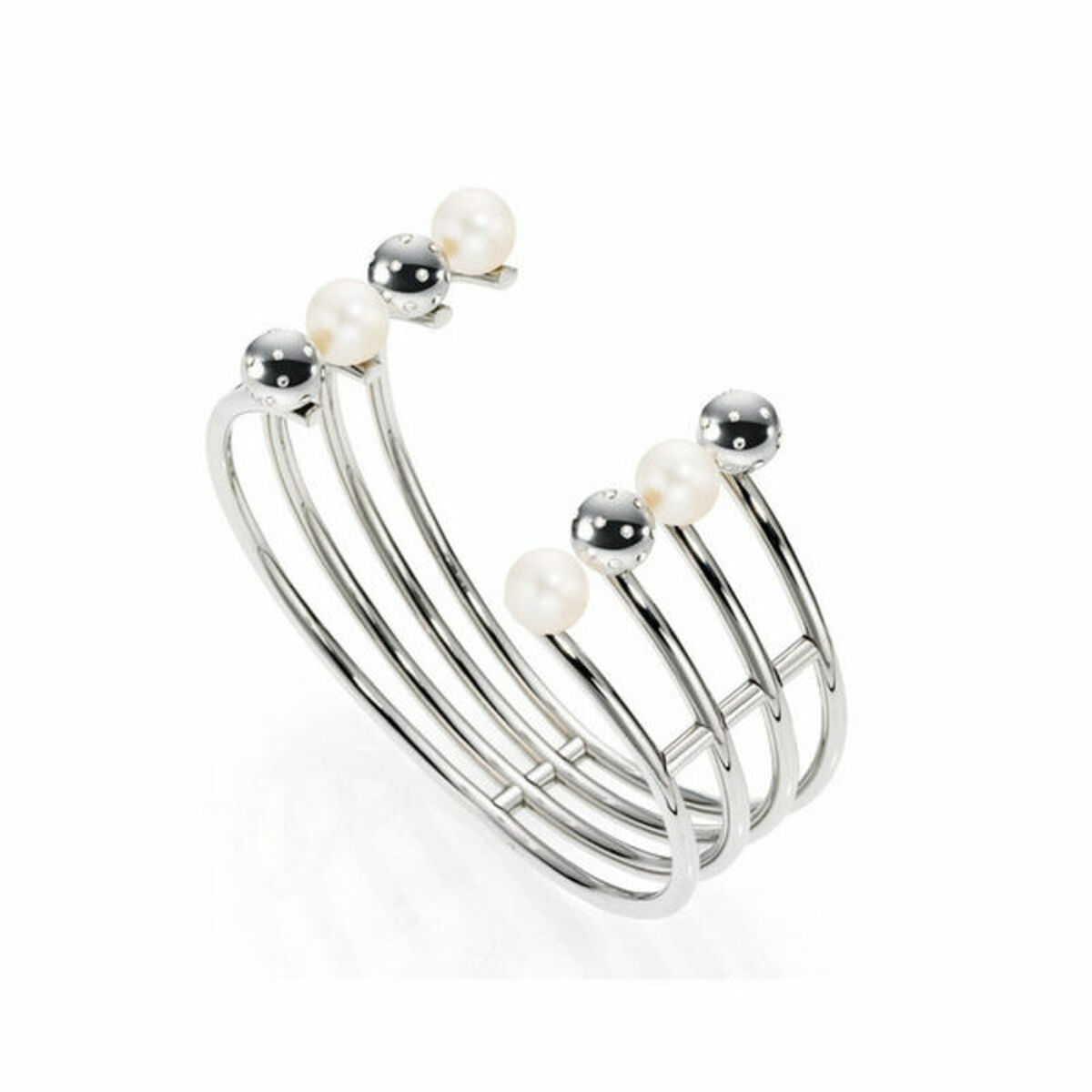
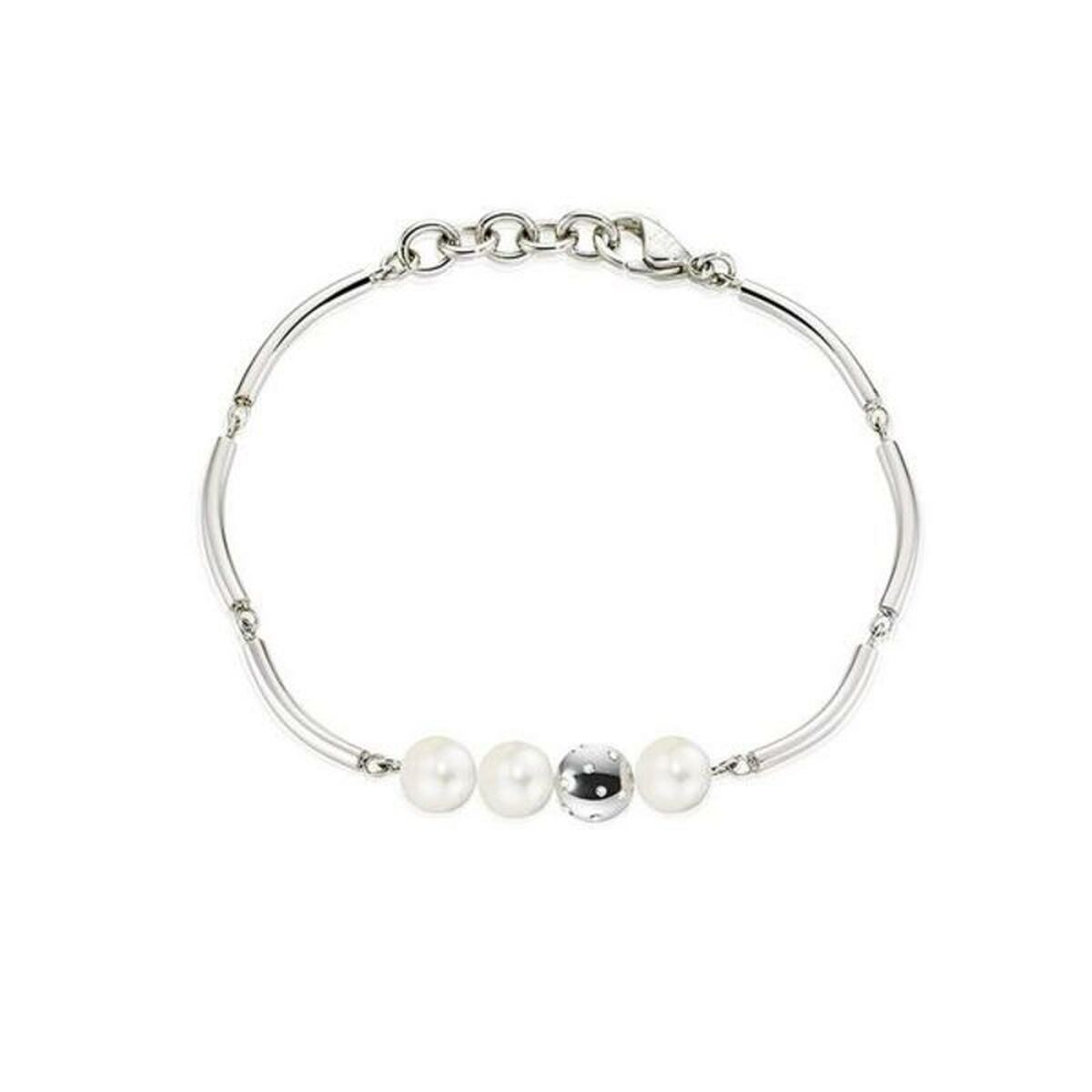
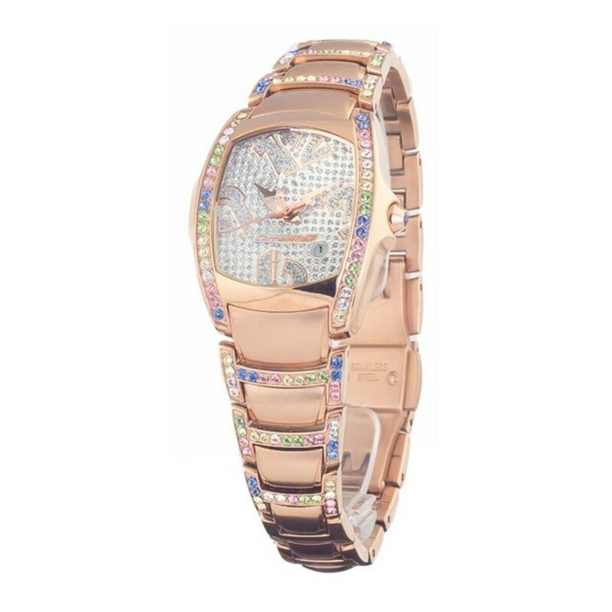
Bracelet Femme Morellato SADX11
Privilege Price 39.30 €Nous vons présentons Bracelet Femme Morellato SADX11 et une vaste gamme de bagues, bracelets, boucles d'oreilles et pendentifs etc. à bon prix. Découvrez d'exclusifs et élégants articles de bijouterie et de bijouterie fantaisie pour tous les goûts.Genre: FemmeMatériel: AcierCouleur: ArgentéDimensions approx.: 20 cmLe coffret de la marque est inclus
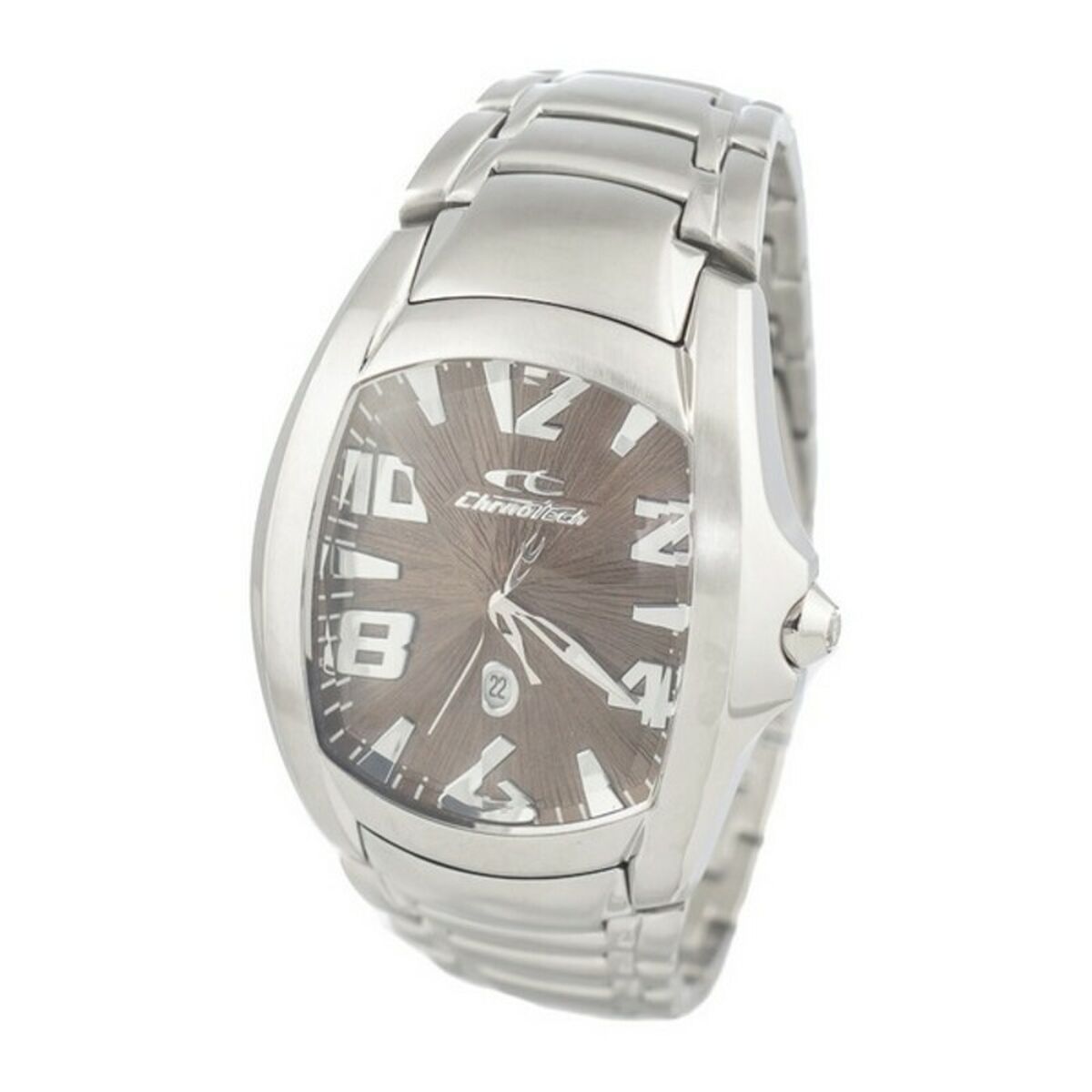
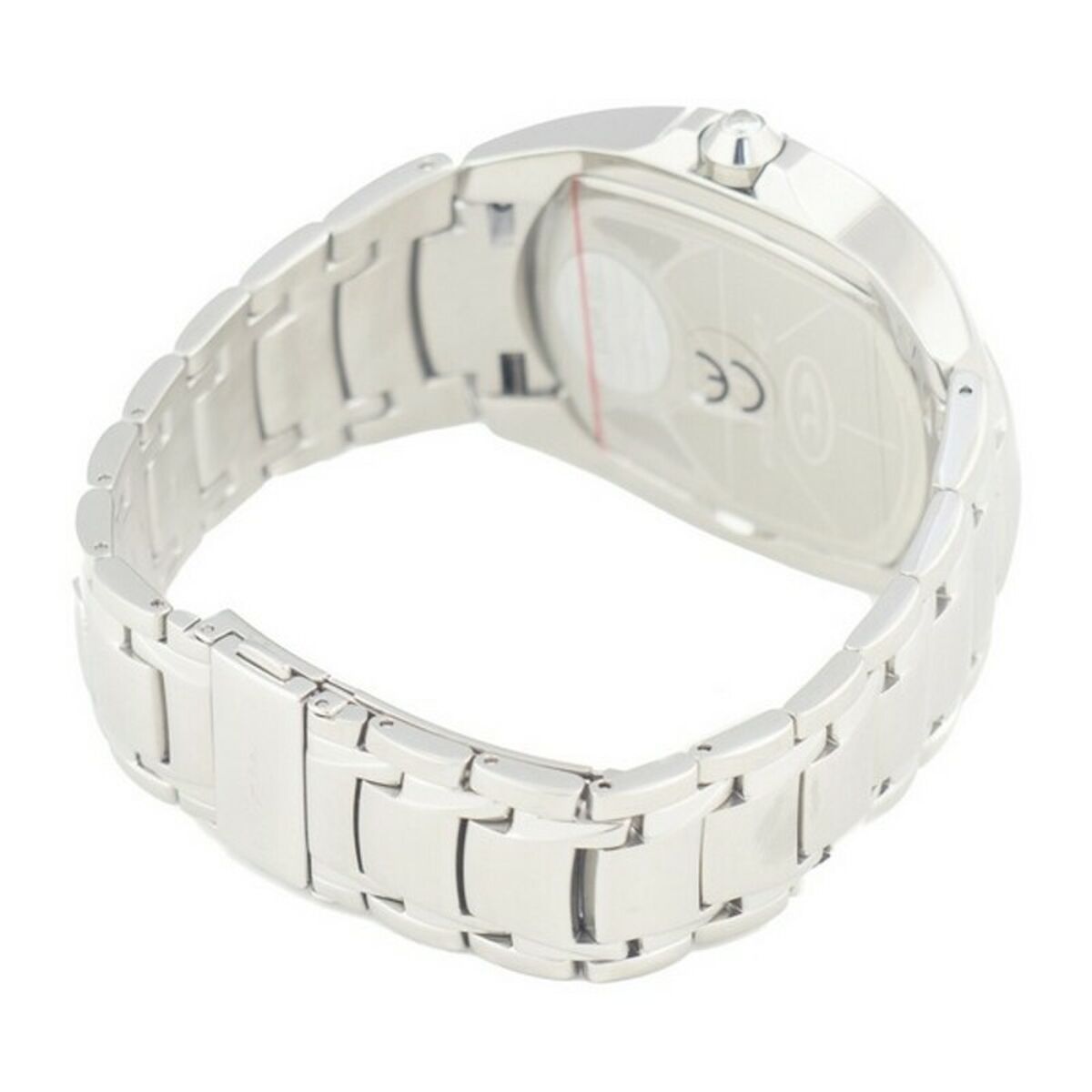
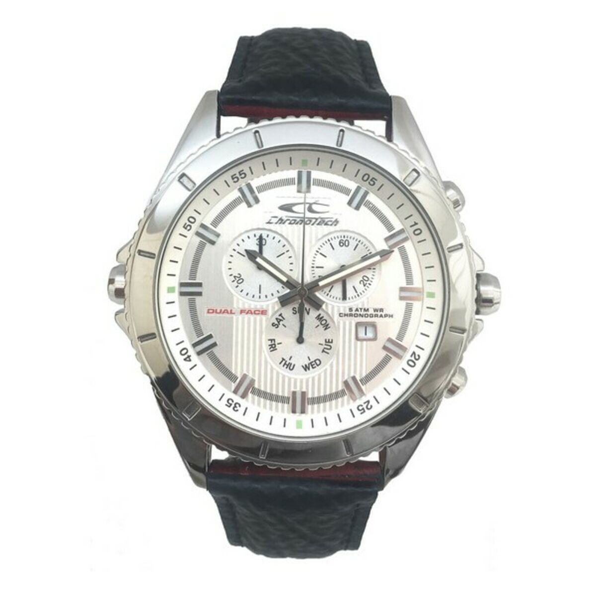
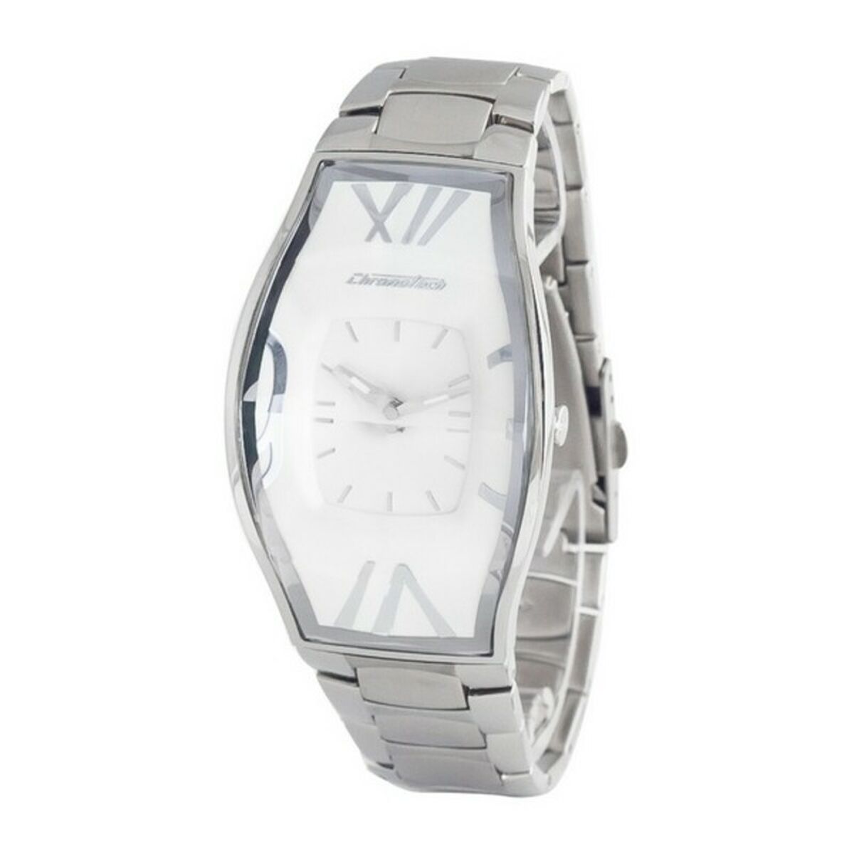
Montre Homme Chronotech CT7988M-65M (Ø 41 mm)
Privilege Price 37.00 €Si vous aimez suivre les dernières tendances en matière de mode et accessoires, achetez Montre Homme Chronotech CT7988M-65M (Ø 41 mm) au meilleur prix.Genre: HommeType de montre: Montre-braceletLiens supplémentaires: NonMatériau du bracelet: AcierMatériau du boîtier de la montre: Acier inoxydableType de mouvement: QuartzVerre: MinéralInclut: Le coffret de la marque est inclusType de fermeture: PressionCouleur du...
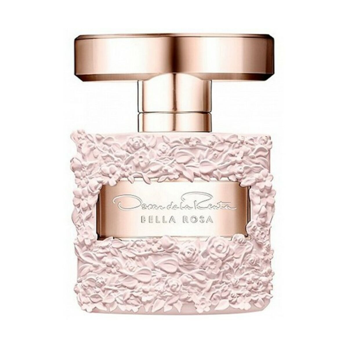
Parfum Femme Bella Rosa Oscar De La Renta I0095896 EDP (100 ml) EDP 100 ml
Privilege Price 36.90 €43.4000 € / 100 ml
Montre Femme Chronotech CT7008LS-06M (Ø 27 mm)
Privilege Price 36.50 €Si vous aimez suivre les dernières tendances en matière de mode et accessoires, achetez Montre Femme Chronotech CT7008LS-06M (Ø 27 mm) au meilleur prix.Couleur: ArgentéGenre: FemmeLiens supplémentaires: NonType de montre: Montre-braceletMatériau du bracelet: AcierMatériau du boîtier de la montre: Acier inoxydableType de mouvement: QuartzVerre: MinéralInclut: Le coffret de la marque est inclusType de fermeture: PressionCouleur...

Montre Homme Chronotech CT7636L-02 (Ø 42 mm)
Privilege Price 36.50 €Si vous aimez suivre les dernières tendances en matière de mode et accessoires, achetez Montre Homme Chronotech CT7636L-02 (Ø 42 mm) au meilleur prix.Genre: HommeType de montre: Montre-braceletDiamètre du boîtier de la montre: Ø 42 mmLiens supplémentaires: NonMatériau du bracelet: CuirMatériau du boîtier de la montre: Acier inoxydableType de mouvement: QuartzVerre: MinéralImperméabilité: 5 atmInclut: Le...
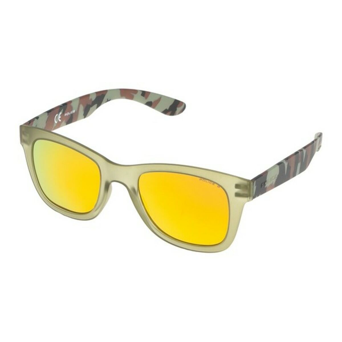
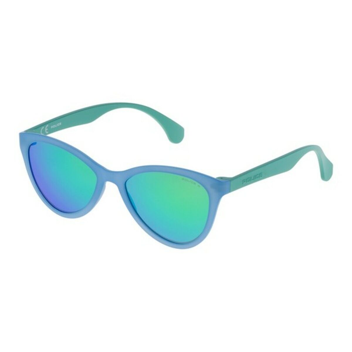
Lunettes de soleil Homme Police S1970 Ø 55 mm
Privilege Price 36.20 €Si vous aimez avoir les dernières nouveautés enmode et accessoires et si les accessoires sont indispensables pour l'ensemble de votre image, ne passez pas à côté de Lunettes de soleil Homme Police S1970 Ø 55 mm ! Bénéficiez des meilleures marques de lunettes de soleil.Genre: HommeMatériel: InjectéMétalPolycarbonateProtection solaire: catégorie 2Branches: 140 mmPont: 16 mmType: Lunettes...
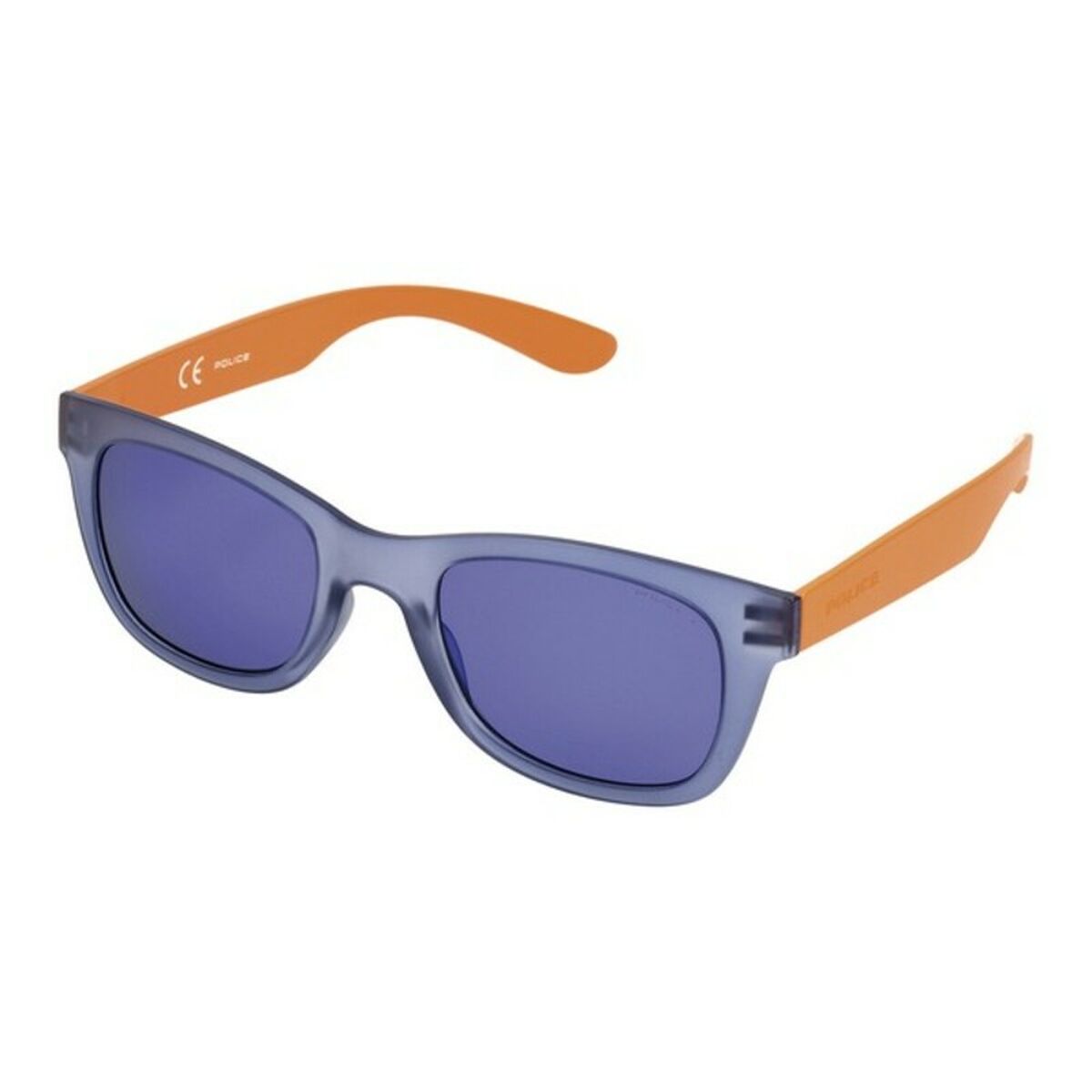
Lunettes de soleil Homme Police SK044 Ø 51 mm
Privilege Price 36.20 €Si vous aimez avoir les dernières nouveautés enmode et accessoires et si les accessoires sont indispensables pour l'ensemble de votre image, ne passez pas à côté de Lunettes de soleil Homme Police SK044 Ø 51 mm ! Bénéficiez des meilleures marques de lunettes de soleil.Genre: HommeMatériel: InjectéPolycarbonateProtection solaire: catégorie 2Branches: 135 mmPont: 18 mmType: Lunettes...
Lunettes de soleil Homme Police SPL086 Ø 65 mm
Privilege Price 36.20 €Si vous aimez avoir les dernières nouveautés enmode et accessoires et si les accessoires sont indispensables pour l'ensemble de votre image, ne passez pas à côté de Lunettes de soleil Homme Police SPL086 Ø 65 mm ! Bénéficiez des meilleures marques de lunettes de soleil.Genre: HommeMatériel: InjectéPolycarbonateProtection solaire: catégorie 2Branches: 140 mmPont: 17 mmType: Lunettes...
Lunettes de soleil Homme Sting SS651548L52B Ø 46 mm
Privilege Price 36.20 €Si vous aimez avoir les dernières nouveautés enmode et accessoires et si les accessoires sont indispensables pour l'ensemble de votre image, ne passez pas à côté de Lunettes de soleil Homme Sting SS651548L52B Ø 46 mm ! Bénéficiez des meilleures marques de lunettes de soleil.Genre: HommeMatériel: InjectéPolycarbonateProtection solaire: catégorie 2Branches: 140 mmPont: 22 mmType: Lunettes...
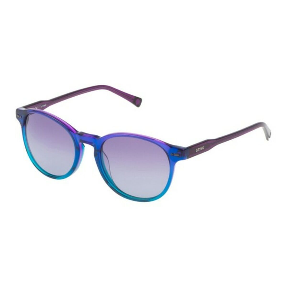
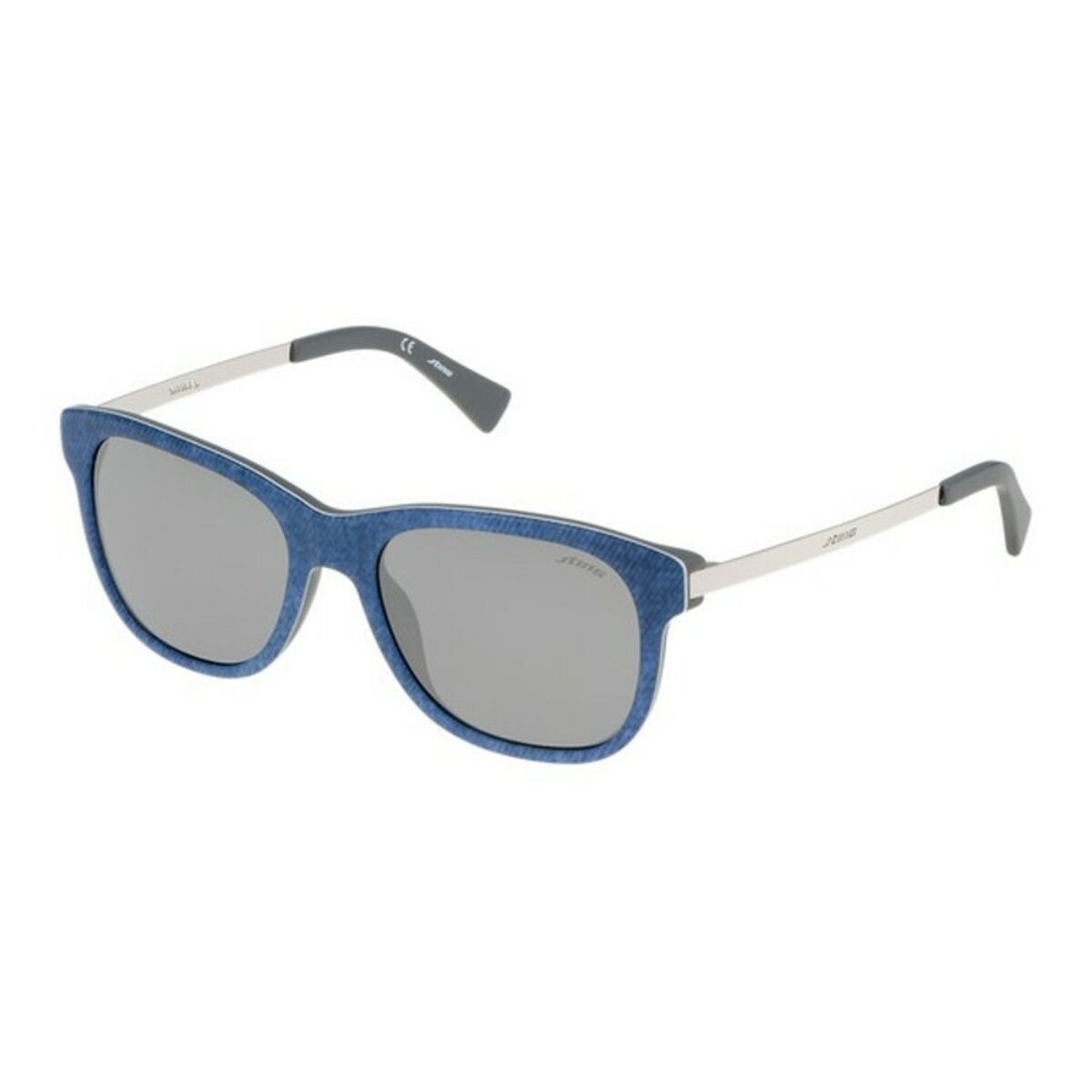
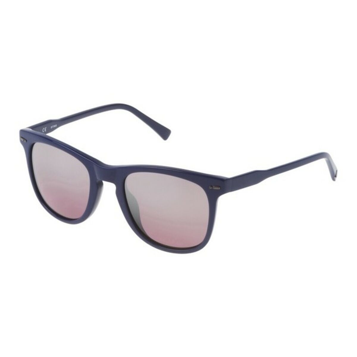
Lunettes de soleil Homme Sting SS6539 Ø 52 mm
Privilege Price 36.20 €Si vous aimez avoir les dernières nouveautés enmode et accessoires et si les accessoires sont indispensables pour l'ensemble de votre image, ne passez pas à côté de Lunettes de soleil Homme Sting SS6539 Ø 52 mm ! Bénéficiez des meilleures marques de lunettes de soleil.Genre: HommeCouleur de la monture: BleuInclut: Le coffret de la marque...

Lunettes de soleil Homme Police S194450GE1V Ø 50 mm
Privilege Price 35.40 €Si vous aimez avoir les dernières nouveautés enmode et accessoires et si les accessoires sont indispensables pour l'ensemble de votre image, ne passez pas à côté de Lunettes de soleil Homme Police S194450GE1V Ø 50 mm ! Bénéficiez des meilleures marques de lunettes de soleil.Genre: HommeMatériel: InjectéPolycarbonateProtection solaire: catégorie 2Branches: 140 mmPont: 22 mmType: Lunettes...

Montre Femme Chronotech CT7896SS-72M (Ø 28 mm)
Privilege Price 33.20 €Si vous aimez suivre les dernières tendances en matière de mode et accessoires, achetez Montre Femme Chronotech CT7896SS-72M (Ø 28 mm) au meilleur prix.Couleur: ArgentéGenre: FemmeLiens supplémentaires: NonType de montre: Montre-braceletMatériau du bracelet: AcierMatériau du boîtier de la montre: Acier inoxydableType de mouvement: QuartzVerre: MinéralInclut: Le coffret de la marque est inclusType de fermeture: PressionCouleur...
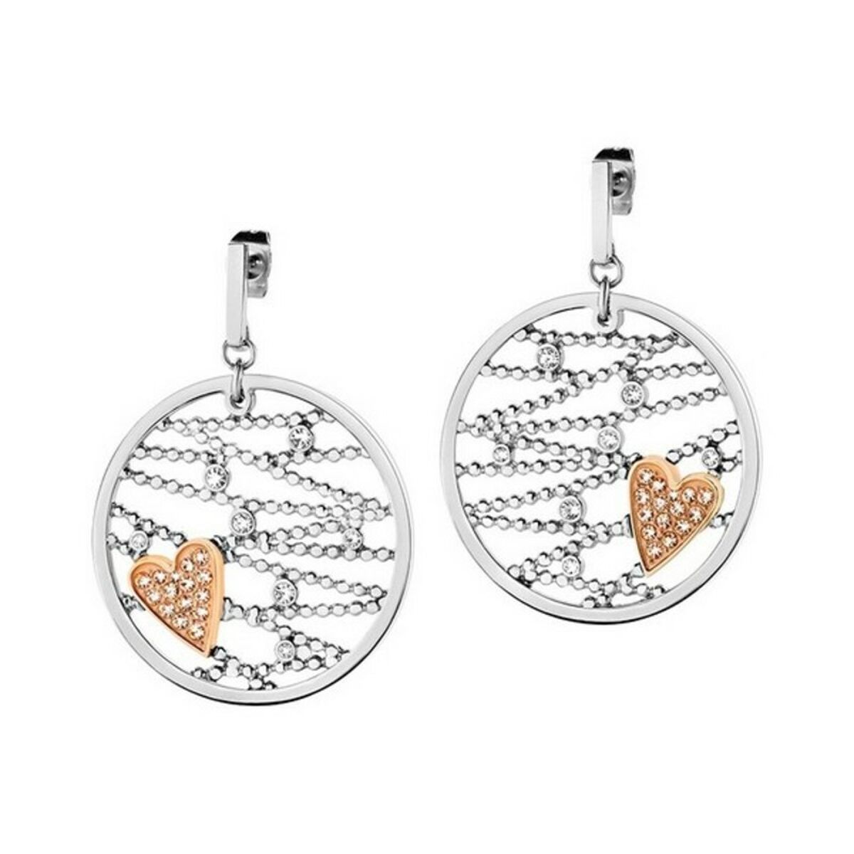
Boucles d´oreilles Femme Morellato SADA06
Privilege Price 33.10 €Nous vons présentons Boucles d´oreilles Femme Morellato SADA06 et une vaste gamme de bagues, bracelets, boucles d'oreilles et pendentifs etc. à bon prix. Découvrez d'exclusifs et élégants articles de bijouterie et de bijouterie fantaisie pour tous les goûts.Genre: FemmeMatériel: AcierCouleur: ArgentéLe coffret de la marque est inclus
Bracelet Femme Morellato SADX12
Privilege Price 33.10 €Nous vons présentons Bracelet Femme Morellato SADX12 et une vaste gamme de bagues, bracelets, boucles d'oreilles et pendentifs etc. à bon prix. Découvrez d'exclusifs et élégants articles de bijouterie et de bijouterie fantaisie pour tous les goûts.Genre: FemmeMatériel: AcierDimensions approx.: 20 cm19 cmCouleur: ArgentéInclut: Le coffret de la marque est inclusType: Bracelet Femme
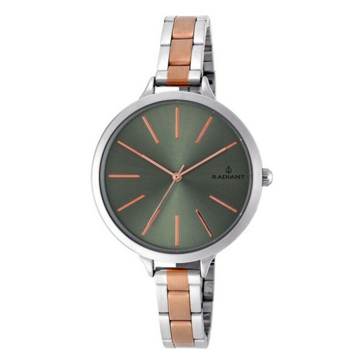

Montre Femme Radiant RA362206 (Ø 41 mm)
Privilege Price 31.70 €Si vous aimez suivre les dernières tendances en matière de mode et accessoires, achetez Montre Femme Radiant RA362206 (Ø 41 mm) au meilleur prix.Genre: FemmeLiens supplémentaires: NonType de montre: Montre-braceletMatériau du bracelet: AcierMatériau du boîtier de la montre: Acier inoxydableType de mouvement: QuartzVerre: MinéralInclut: Le coffret de la marque est inclusType de fermeture: PressionCouleur du...

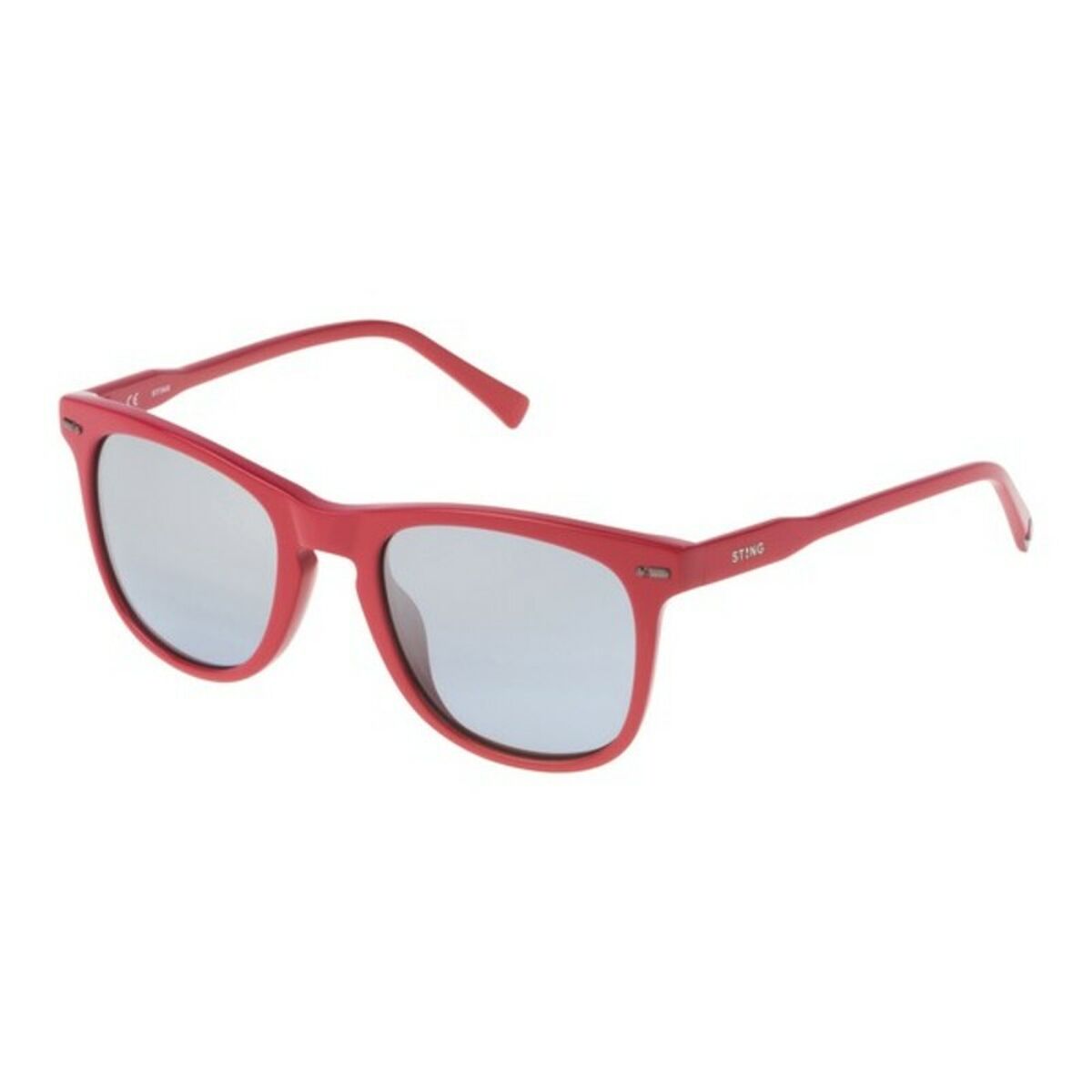
Lunettes de soleil Homme Sting SS6428V5009RE Ø 50 mm
Privilege Price 30.40 €Si vous aimez avoir les dernières nouveautés enmode et accessoires et si les accessoires sont indispensables pour l'ensemble de votre image, ne passez pas à côté de Lunettes de soleil Homme Sting SS6428V5009RE Ø 50 mm ! Bénéficiez des meilleures marques de lunettes de soleil.Genre: HommeMatériel: AcétatePolycarbonateProtection solaire: catégorie 2Branches: 135 mmPont: 19 mmType: Lunettes...
Lunettes de soleil Homme Sting SS6515487SFV Ø 48 mm
Privilege Price 30.40 €Si vous aimez avoir les dernières nouveautés enmode et accessoires et si les accessoires sont indispensables pour l'ensemble de votre image, ne passez pas à côté de Lunettes de soleil Homme Sting SS6515487SFV Ø 48 mm ! Bénéficiez des meilleures marques de lunettes de soleil.Genre: HommeMatériel: InjectéPolycarbonateProtection solaire: catégorie 2Branches: 140 mmPont: 20 mmType: Lunettes...
Lunettes de soleil Homme Sting SS653750NKWX ø 54 mm
Privilege Price 30.40 €Si vous aimez avoir les dernières nouveautés enmode et accessoires et si les accessoires sont indispensables pour l'ensemble de votre image, ne passez pas à côté de Lunettes de soleil Homme Sting SS653750NKWX ø 54 mm ! Bénéficiez des meilleures marques de lunettes de soleil.Genre: HommeMatériel: AcétatePolycarbonateProtection solaire: catégorie 2Branches: 140 mmPont: 19 mmType: Lunettes...
Lunettes de soleil Homme Sting SS654356W54P Ø 49 mm
Privilege Price 30.40 €Si vous aimez avoir les dernières nouveautés enmode et accessoires et si les accessoires sont indispensables pour l'ensemble de votre image, ne passez pas à côté de Lunettes de soleil Homme Sting SS654356W54P Ø 49 mm ! Bénéficiez des meilleures marques de lunettes de soleil.Genre: HommeMatériel: InjectéPolycarbonateProtection solaire: catégorie 2Branches: 135 mmPont: 22 mmType: Lunettes...
Lunettes de soleil Homme Sting Ss654 Ø 51 mm
Privilege Price 30.40 €Si vous aimez avoir les dernières nouveautés enmode et accessoires et si les accessoires sont indispensables pour l'ensemble de votre image, ne passez pas à côté de Lunettes de soleil Homme Sting Ss654 Ø 51 mm ! Bénéficiez des meilleures marques de lunettes de soleil.Genre: HommeMatériel: AcétateMétalPolycarbonateProtection solaire: catégorie 2Branches: 140 mmPont: 22 mmType: Lunettes...
Lunettes de soleil Homme Sting SS6581512GHX Ø 51 mm
Privilege Price 30.40 €Si vous aimez avoir les dernières nouveautés enmode et accessoires et si les accessoires sont indispensables pour l'ensemble de votre image, ne passez pas à côté de Lunettes de soleil Homme Sting SS6581512GHX Ø 51 mm ! Bénéficiez des meilleures marques de lunettes de soleil.Genre: HommeMatériel: AcétatePolycarbonateProtection solaire: catégorie 2Branches: 140 mmPont: 22 mmType: Lunettes...
Lunettes de soleil Homme Sting SS658151991X Ø 52 mm
Privilege Price 30.40 €Si vous aimez avoir les dernières nouveautés enmode et accessoires et si les accessoires sont indispensables pour l'ensemble de votre image, ne passez pas à côté de Lunettes de soleil Homme Sting SS658151991X Ø 52 mm ! Bénéficiez des meilleures marques de lunettes de soleil.Genre: HommeMatériel: AcétatePolycarbonateProtection solaire: catégorie 2Branches: 140 mmPont: 20 mmType: Lunettes...
Lunettes de soleil Homme Sting SST00855881X Ø 55 mm
Privilege Price 30.40 €Si vous aimez avoir les dernières nouveautés enmode et accessoires et si les accessoires sont indispensables pour l'ensemble de votre image, ne passez pas à côté de Lunettes de soleil Homme Sting SST00855881X Ø 55 mm ! Bénéficiez des meilleures marques de lunettes de soleil.Genre: HommeMatériel: InjectéAcétatePolycarbonateProtection solaire: catégorie 2Branches: 145 mmPont: 19 mmType: Lunettes...
Lunettes de soleil Homme Sting SST009530892 Ø 53 mm
Privilege Price 30.40 €Si vous aimez avoir les dernières nouveautés enmode et accessoires et si les accessoires sont indispensables pour l'ensemble de votre image, ne passez pas à côté de Lunettes de soleil Homme Sting SST009530892 Ø 53 mm ! Bénéficiez des meilleures marques de lunettes de soleil.Genre: HommeMatériel: InjectéAcétatePolycarbonateProtection solaire: catégorie 2Branches: 145 mmPont: 20 mmType: Lunettes...
Lunettes de soleil Homme Sting SST010530AGW Ø 53 mm
Privilege Price 30.40 €Si vous aimez avoir les dernières nouveautés enmode et accessoires et si les accessoires sont indispensables pour l'ensemble de votre image, ne passez pas à côté de Lunettes de soleil Homme Sting SST010530AGW Ø 53 mm ! Bénéficiez des meilleures marques de lunettes de soleil.Genre: HommeMatériel: InjectéAcétatePolycarbonateProtection solaire: catégorie 2Branches: 135 mmPont: 17 mmType: Lunettes...

Montre Femme Chronotech CT7932M-08M (Ø 36 mm)
Privilege Price 30.20 €Si vous aimez suivre les dernières tendances en matière de mode et accessoires, achetez Montre Femme Chronotech CT7932M-08M (Ø 36 mm) au meilleur prix.Genre: FemmeLiens supplémentaires: NonType de montre: Montre-braceletdiamètre approx.: 36 mmMatériau du bracelet: AcierMatériau du boîtier de la montre: Acier inoxydableType de mouvement: QuartzVerre: MinéralInclut: Le coffret de la marque est inclusType de...
Montre Femme Chronotech CT7896SS-73M (Ø 27 mm)
Privilege Price 30.20 €Si vous aimez suivre les dernières tendances en matière de mode et accessoires, achetez Montre Femme Chronotech CT7896SS-73M (Ø 27 mm) au meilleur prix.Couleur: ArgentéGenre: FemmeLiens supplémentaires: NonType de montre: Montre-braceletMatériau du bracelet: AcierMatériau du boîtier de la montre: Acier inoxydableType de mouvement: QuartzVerre: MinéralInclut: Le coffret de la marque est inclusType de fermeture: PressionCouleur...


Lunettes de soleil Homme Italia Independent 0500-120-120 Doré Ø 55 mm
Privilege Price 29.90 €Si vous aimez avoir les dernières nouveautés enmode et accessoires et si les accessoires sont indispensables pour l'ensemble de votre image, ne passez pas à côté de Lunettes de soleil Homme Italia Independent 0500-120-120 Doré Ø 55 mm ! Bénéficiez des meilleures marques de lunettes de soleil.Genre: HommeMatériel: MétalPolycarbonateProtection solaire: catégorie 3Branches: 145 mmPont: 20...
Lunettes de soleil Homme Italia Independent 0500-027-000 Ø 55 mm
Privilege Price 29.90 €Si vous aimez avoir les dernières nouveautés enmode et accessoires et si les accessoires sont indispensables pour l'ensemble de votre image, ne passez pas à côté de Lunettes de soleil Homme Italia Independent 0500-027-000 Ø 55 mm ! Bénéficiez des meilleures marques de lunettes de soleil.Genre: HommeMatériel: MétalPolycarbonateProtection solaire: catégorie 3Branches: 145 mmPont: 20 mmType:...
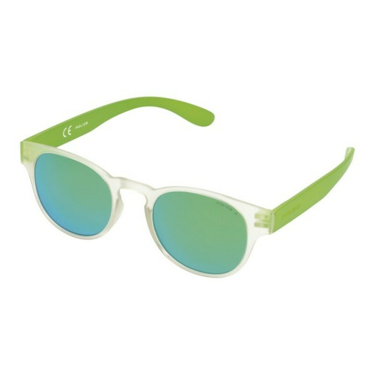
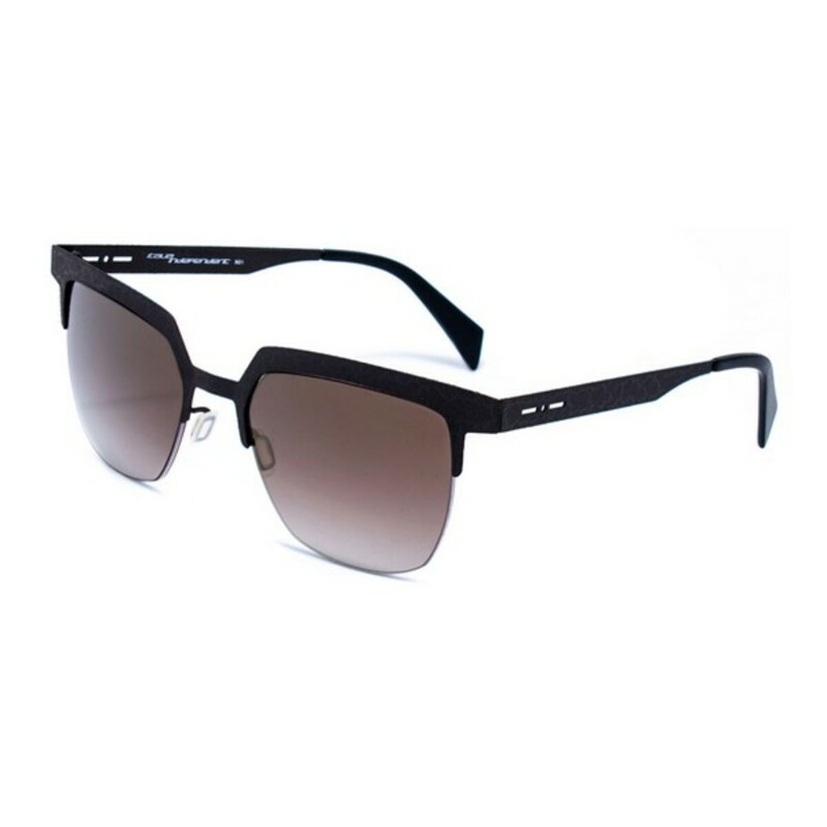
Lunettes de soleil Femme Italia Independent 0204-018-000
Privilege Price 29.90 €Si vous aimez avoir les dernières nouveautés enmode et accessoires et si les accessoires sont indispensables pour l'ensemble de votre image, ne passez pas à côté de Lunettes de soleil Femme Italia Independent 0204-018-000 ! Bénéficiez des meilleures marques de lunettes de soleil.Genre: FemmeMatériel: MétalBranches: 140 mmPont: 17 mmType: Lunettes de soleil FemmeInclut: Le coffret...
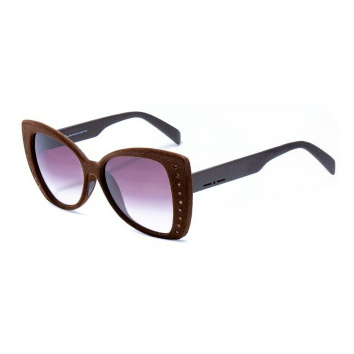
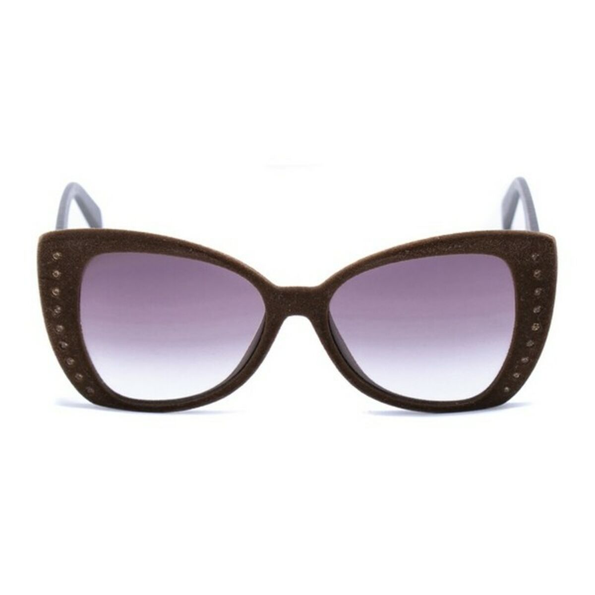
Lunettes de soleil Femme Italia Independent 0503-CRK-044
Privilege Price 29.90 €Si vous aimez avoir les dernières nouveautés enmode et accessoires et si les accessoires sont indispensables pour l'ensemble de votre image, ne passez pas à côté de Lunettes de soleil Femme Italia Independent 0503-CRK-044 ! Bénéficiez des meilleures marques de lunettes de soleil.Genre: FemmeMatériel: MétalBranches: 140 mmPont: 19 mmType: Lunettes de soleil FemmeInclut: Le coffret...
Lunettes de soleil Femme Italia Independent 0904CV-044-000
Privilege Price 29.90 €Si vous aimez avoir les dernières nouveautés enmode et accessoires et si les accessoires sont indispensables pour l'ensemble de votre image, ne passez pas à côté de Lunettes de soleil Femme Italia Independent 0904CV-044-000 ! Bénéficiez des meilleures marques de lunettes de soleil.Genre: FemmeMatériel: AcétateBranches: 140 mmPont: 16 mmType: Lunettes de soleil FemmeFiltre solaire: catégorie...
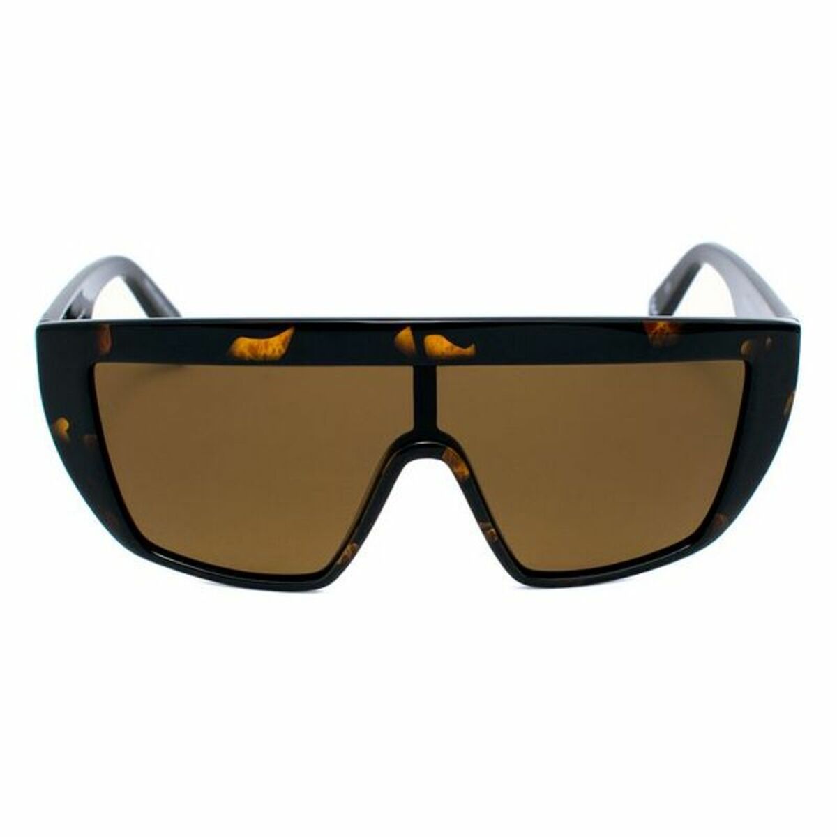
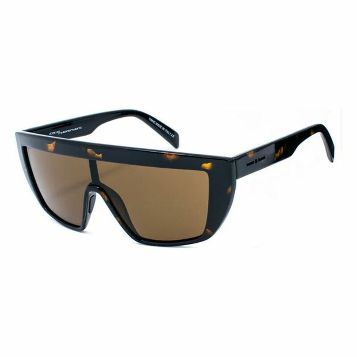
Lunettes de soleil Homme Italia Independent 0912-DHA-044
Privilege Price 29.90 €Si vous aimez avoir les dernières nouveautés enmode et accessoires et si les accessoires sont indispensables pour l'ensemble de votre image, ne passez pas à côté de Lunettes de soleil Homme Italia Independent 0912-DHA-044 ! Bénéficiez des meilleures marques de lunettes de soleil.Matériel: AcétatePolycarbonateProtection solaire: catégorie 3Branches: 140 mmGenre: HommeType: Lunettes de soleil HommeInclut: Le...